
ORIGINAL: Forbes
Shel Israel, Contributor
6/03/2013
NOTE–I am writing a book called Age of Context with Robert Scoble. It is expected to be complete in October. Following is an excerpt from a chapter called Contextual Cities and the New Urbanists.
Herman Hollerith was born in Buffalo in the late 1800s. He studied to be a mining engineer and wound up teaching at MIT. It is said he tinkered a lot, and in 1890, he invented the first electric tabulating machine.
Finding that it could count heads with unprecedented speed, the US Census Bureau became Hollerith’s first customer. He thought the new machine might provide him with a business opportunity, so he founded the Tabulating Machine Company [TMC].
Over the next few years, TMC merged with several other companies, one the maker of a cheese-slicing device. When Thomas J. Watson became president in 1915, he focused on making machines for businesses worldwide. Watson was fond of the literal and straightforward. He renamed the merged entity International Business Machines, or IBM for short.
 IBM, the most enduring of all technology companies, has a long history of reinventing itself as times change. It has transcended from tabulating machines to mainframes, to PCs, to providing software and services for large organizations.
 IBM does quite well in its current business, but so do several other companies and to outsiders each seems to closely resemble the other.
Perhaps it was with that in mind that in 2006, the company set up a series of meetings with employees, partners and customers called ‘innovation jams.’ To see its own future, IBM stepped back to look at global issues, such as population, pollution, economics and health.
They started examining how their current team of over 425,000 employees in about 200 countries could use their existing skills to make a better world and in so doing, strengthen the company’s software and services position.
Among IBM’s assets is that it understands data and uses it to devise anticipatory systems that predict unforeseen events. IBM has taken that and is applying it to its Smarter Planet initiative, addressing the complex global issues of health, banking and cities.
The Smarter Cities initiative is now a global business for IBM, with projects all over the world. When they examine urban centers, they watch for emerging patterns from which IBM can glean insights for municipal clients. Pattern recognition lets them identify problems sooner, and resolve them faster.
Although the practice is just a few years old, IBM has already accumulated a few impressive accomplishments. While the company is globally focused, we asked them specifically about US-based projects. Here are our favorites of the ones they submitted:
- Memphis. Police say that IBM’s predictive analytics have helped them identify criminal hot spots that allow them to anticipate where—and when– serious crimes are likely to occur. Based on the data, they reallocated patrol cars and other resources, reducing major and violent crime by as much as 30 percent. Pattern recognition also helps police understand trends that previously went unnoticed. For example, they now know that on rainy nights, car theft rises.
- San Francisco. IBM’s use of data and embedded sensors has reduced pollution emanating from the city’s thousand miles of sewer lines. Public utilities reports that IBM’s preventive intelligence has helped reduce repair costs by 11 percent.
- Chattanooga-Hamilton County. The county uses IBM predictive analytics to understand how adverse patterns develop. This allows them to identify at-risk children earlier, so educators can adjust personal attention and curriculum a factor in increasing the graduation rate by eight percent. One facility, the Howard School of Academics and Technology reported a 200 percent increase in the graduation rate over the program’s first six years.
- Miami-Dade County. IBM has helped the 35 Dade County municipalities to share data, thus making it easier to collaborate in a wide array of areas including water, transportation, and law enforcement. They are also sharing contextual technologies to make government more transparent. A new water project alone is expected to save the county $1 million per year.
IBM has also served as a global recruiter, mentor and partner for startups focused on solving city problems with contextual technology. A few who are associated with IBM to various degrees include:
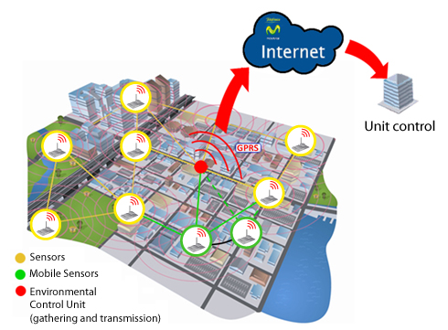
- Bitcarrier, a Barcelona-based startup has created a contextual traffic platform, comprised of sensors, Wifi, and just a little intelligence,” Ricardo Fernandez, the company’s chief operating officer told us. The platform gathers data from up to 20 million points daily across a city’s grid, shown on municipal traffic ‘heat maps.’ Managers use the information to reroute traffic, simultaneously reducing traffic, noise and air pollution. The sensors replace cameras, increasing privacy and reducing costs by up to 90 percent, Fernandez estimated. Traffic administrators can respond quickly to accidents and other surprises. Bitcarrier also improves public transportation systems. City buses adjust so they don’t drive around half-empty, and extra buses can be dispatched more quickly. Most cities cannot adjust traffic signals to accommodate events such as a concert because they run on data that is up to three-years-old and can’t adjust to current information. When we talked in March 2013, Bitcarrier was in use in Panama City, Helsinki, Barcelona, Madrid and Zaragosa, Spain and in late discussions with several additional cities.
- Libelium was also a Spanish-based finalist in IBM SmartCamp, a global series of IBM-sponsored startup competitions. Libelium is Latin for dragonfly. CEO Alicia Asin explained that the company is focused on the Internet of Things that we described in Chapter 1. The company deploys insect-like swarms of tiny sensors called motes, which report on changes in a wide range of activities impacting safety, efficiency, vegetation growth and sustainability. It is an open sensor platform that was being used by over 2000 developers in April 2013. Libelium technology helps vineyards decide on which varietals of grapes to grow based on environmental conditions. Libelium’s main business is creating smart parking systems, mostly in urban areas, all over the world. Magnetic sensors are installed under pavement to determine whether a car is parked in a space or not. The system sees the GPS of a car looking for parking and can direct it to the nearest open spot via a mobile app. According to Asin, the smart parking system is politically popular because it pays for itself by ensuring cars pay to park or get fined. The efficiency reduces air and noise pollution. ibelium’s most dramatic sensor effort was in Fukushima, Japan following the 2011 nuclear disaster. Upon the government’s request, Libelium designed a sensor panel that was installed in and around areas suspected of radiation contamination. Each panel served as an autonomous, wireless Geiger counter, which then broadcasted realtime information into a cloud-based open network. Citizens published radiation readings from their locations to the site, and those measurements appeared on a map alongside values from inside contaminated zones. “After a couple of weeks, we had a radiation map of Japan. It represented a common thought for people to share and be helpful to all,” Asin said. “It’s where I came to understand the power of citizens in a Smart Cities program.” Moving forward, the system will help the country respond faster and more effectively if another tsunami strikes.
- Nooly, the Israeli-based hyper-local sensor-based weather detection service we told you about in our contextual car chapter, is another early-phase company working with IBM in various cities. Unlike conventional weather forecasts, Nooly covers small distances and sees weather changes one or two hours before they hit, including hurricanes, snowstorms or flooding. According to CEO Yaron Reich, Nooly can warn cities when weather is about to cause traffic snarls and where accidents are likely to happen. Cities can use the short lead-time to make fast routing adjustments. Reich sees places where Nooly sensors could even save lives. The sensors could detect a flash flood and underground crews could be warned to evacuate to avoid drowning. Likewise, Nooly can serve as a tool for first responders such as firefighters who need to understand wind, rain, and other factors. Less dramatically, Nooly can help cities save money and provide more efficient services. While municipal power consumption is usually predictive along seasonal patterns, they cannot account for heat waves or frost where quick grid adjustments can save energy and costs. Likewise, Nooly can predict evaporation rates in public parks during excessively hot days and can adjust watering systems accordingly.
- Waze, the Israeli startup, we talked about in the previous chapter, can help cities get smarter about changing traffic light patterns to reduce traffic. Users help each other route around trouble spots, reducing travel times for people, but also helping urban traffic run more efficiently. By providing realtime data that can help traffic managers reroute traffic around trouble spots and show the best place to find parking, restrooms, or motorist amenities.

No hay comentarios:
Publicar un comentario
Nota: solo los miembros de este blog pueden publicar comentarios.