Mostrando entradas con la etiqueta Nivel del Mar. Mostrar todas las entradas

martes, 1 de octubre de 2013

La influencia humana en el clima es clara, según el informe del IPCC


ESTOCOLMO, 27 de septiembre- La influencia humana en el sistema climático es clara. Es evidente en la mayoría de las regiones del planeta, según concluye la nueva evaluación del Grupo Intergubernamental de Expertos sobre el Cambio Climático (IPCC).

Es sumamente probable que la influencia humana haya sido la causa dominante del calentamiento observado desde mediados del siglo XX. Esta evidencia ha ido en aumento gracias a un mayor número de observaciones de mayor calidad, a una mejor comprensión de la respuesta del sistema climático y a unos mejores modelos climáticos.

El calentamiento en el sistema climático es inequívoco y desde 1950 son muchos los cambios observados en todo el sistema climático que no tienen precedentes en los últimos decenios a milenios. Cada uno de los tres últimos decenios ha sido sucesivamente más cálido en la superficie de la Tierra que cualquier decenio anterior desde 1850, según se recoge en el Resumen para responsables de políticas del informe de evaluación Climate Change 2013: the Physical Science Basis ( Cambio climático 2013: Base de ciencia física) del Grupo de trabajo I del IPCC, aprobado el viernes por los gobiernos miembros del IPCC en Estocolmo ( Suecia).
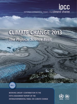
Climate Change 2013: the Physical Science Basis. (Cover). Image: IPCC
El señor Qin Dahe, copresidente del Grupo de trabajo I del IPCC, señala que “las observaciones de los cambios en el sistema climático están basadas en varias líneas de evidencia independiente. La evaluación de la ciencia que hemos realizado concluye que la atmósfera y el océano se han calentado, el volumen de nieve y hielo ha disminuido, el nivel me dio global del mar se ha elevado y la s concentraci ones de gases de efecto invernadero han aumentado”.

El señor Thomas Stocker, el otro copresidente del Grupo de trabajo I del IPCC, afirma que "las emisiones continuas de gases de efecto invernadero causarán un mayor calentamiento y nuevos cambios en todos los componentes del sistema climático. Para contener el cambio climático, será necesario reducir de forma sustancial y sostenible las emisiones de gases de efecto invernadero".

El señor Stocker añade que “las proyecciones apuntan a que para finales del siglo XXI es probable que la temperatura global en superficie sea superior en 1,5ºC a la del período entre 1850 y 1900 en todos los escenarios considerados, excepto en el que comprende los niveles más bajos de gases de efecto invernadero y aerosoles; y es probable que sea superior en 2ºC en los dos escenarios que comprenden los niveles más elevados". Asimismo dice que “es muy probable que las olas de calor ocurran con mayor frecuencia y duren más. Conforme se vaya calentando la Tierra, prevemos que las actuales regiones húmedas recibirán mayores precipitaciones, y las regiones secas, menos, si bien con excepciones”.

Las proyecciones del cambio climático se basan en un nuevo conjunto de cuatro escenarios de concentraciones futuras de aerosoles y gases de efecto invernadero y contemplan un amplio abanico de futuros posibles. El informe d el Grupo de trabajo I evaluó el cambio a escalas global y regional para el principio, la mitad y el final del siglo XXI.

El señor Qin Dahe afirma que “conforme se caliente el océano y se reduzcan los glaciares y los mantos de hielo, el nivel medio global del mar seguirá aumentando, pero a un ritmo más rápido del experimentado en los últimos 40 años”. El informe constata con un nivel de confianza alto que el calentamiento del océano es un factor dominante en la energía almacenada en el sistema climático y representa más del 90% de la energía acumulada entre 1971 y 2010.

El señor Stocker concluye que “como resultado de nuestras emisiones de CO 2 pasadas, presentes y futuras previstas, el cambio climático persistirá inevitablemente y los efectos perdurarán durante muchos siglos, incluso aunque pararan las emisiones de CO2”.

El señor Rajendra Pachauri, Presidente del IPCC, dice que “este Resumen para responsables de políticas del Grupo de trabajo I aporta importantes conocimientos a la base científica del cambio climático. Ofrece un sólido fundamento para las consideraciones de los impactos del cambio climático en los sistemas humanos y naturales así como medios para afrontar el desafío del cambio climático”. Estos y otros son los aspectos evaluados en las contribuciones de los Grupos de trabajo II y III que se publicarán en marzo y abril de 2014. El ciclo del Quinto Informe de Evaluación del IPCC concluirá con la publicación de su Informe de síntesis en octubre de 2014.

El señor Pachauri declara: “Deseo dar las gracias a los copresidentes del Grupo de trabajo I y a los cientos de científicos y expertos que han trabajado como autores y revisores para elaborar un resumen de amplio alcance y científicamente sólido. También quisiera hacer extensivo mi agradecimiento a los más de mil revisores expertos de todo el mundo que han aportado sus conocimientos a la preparación de esta evaluación”.

La contribución del Resumen para responsables de políticas del Grupo de trabajo I al Quinto Informe de Evaluación del IPCC se puede consultar en www.climatechange2013.org o www.ipcc.ch.

Principales conclusiones

Veáse la Ficha informativa sobre las afirmaciones principales del Resumen para responsables de políticas del Quinto Informe de Evaluación del IPCC del Grupo de trabajo I, disponible en la siguiente dirección: www.climatechange2013.org.

Antecedentes
El Grupo de trabajo I está copresidido por el señor Qin Dahe, de la Administración Meteorológica de China, situada en Beijing ( China), y el señor Thomas Stocker, de la Universidad de Berna (Suiza). La Universidad de Berna alberga la Unidad de apoyo técnico del Grupo de trabajo I, que está financiada por el Gobierno de Suiza.

En la 28ª reunión del IPCC celebrada en abril de 2008, los miembros del IPCC decidieron elaborar el Quinto Informe de Evaluación. En julio de 2009 se organizó una reunión exploratoria para determinar el alcance y el esquema de dicho informe. En octubre de 2009, en la 31 ª reunión del IPCC, se aprobaron las grandes líneas resultantes para las tres contribuciones de los Grupos de trabajo al Quinto Informe de Evaluación.

El Resumen para responsables de políticas del Quinto Informe de Evaluación del IPCC del Grupo de trabajo I se aprobó en la 12ª reunión del Grupo de trabajo I del IPCC, celebrada del 23 al 26 de septiembre de 2013 en Estocolmo (Suecia), y se publicó el 27 de septiembre.

El proyecto final del informe del Grupo de trabajo I ( versión distribuida a los gobiernos el 7 de junio de 2013), que contenía el Resumen técnico, 14 capítulos y un A tlas de las proyecciones climáticas mundiales y regionales, se publicará en línea sin revisar el lunes 30 de septiembre. Tras realizar la revisión editorial, la maquetación y las comprobaciones finales para subsanar errores y llevar a  cabo los ajustes para los cambios efectuados en el Resumen para responsables de políticas, el informe completo del Grupo de trabajo I se publicará en línea en enero de 2014 y Cambridge University Press lo publicará en forma de libro unos meses después.

La evaluación del Grupo de trabajo I abarca unas 2.500 páginas de texto y se basa en millones de observaciones y más de 2 millones de gigabytes de datos numéricos extraídos de simulaciones de modelos climáticos. Se citan más de 9.200 publicaciones científicas, de las cuales más de sus tres cuartas partes se han publicado desde la última evaluación del IPCC realizada en 2007.

En este informe de evaluación del IPCC se utilizan términos específicos para indicar la verosimilitud evaluada de un resultado o consecuencia. En relación c on esos términos: prácticamente seguro significa que la probabilidad de ocurrencia es de l 99 – 100%; sumamente probable, del 95 – 100%; muy probable, del 90 – 100%; y probable, del 66 – 100%. Para más información, consulte la nota orientativa del IPCC sobre los va lores de incertidumbre:
https://www.ipcc-wg1.unibe.ch/guidancepaper/ar5_uncertainty-guidance-note.pdf.

Para más información, diríjase a:
Oficina de prensa del IPCC, correo electrónico: ipcc-media@wmo.int
Jonathan Lynn, + 41 22 730 8066 o
Werani Zabula, + 41 22 730 8120
Contacto del Grupo de trabajo I del IPCC para los medios de comunicación,
correo electrónico: media@ipcc.unibe.ch
Pauline Midgley, +41 31 631 5620
Siga al IPCC en Facebook y Twitter

ORIGINAL: IPCC - COMUNICADO DE PRENSA DEL IPCC
IPCC Secretariat
27 de septiembre de 2013

c/o WMO ·
7 bis, Avenue de la Paix ·
C.P: 2300 · CH-1211 
Geneva 2 · Switzerland
telephone +41 22 730 8208 / 54 / 84
· fax +41 22 730 8025 / 13
· email IPCC-Sec@wmo.int
· www.ipcc.ch
OMM PNUMA 2013/20/PR

jueves, 8 de agosto de 2013

‘Dangerous Degrees’: Climate change risks prosperity, security and health

ORIGINAL: TCKTCKTCK
TckTckTck 
August 8, 2013


Dry lake bed caused by prolonged drought in Australia, Creative Commons: Denis Fox, 2006
Today, three Australian leaders, each from different backgrounds, came together in hard hats and fluoro vests to launch a new report by The Climate Institute warning of the ways in which climate change risks the health, prosperity and security of the world.

Entitled “Dangerous Degrees: Risking Australians’ prosperity, security, and health,” the report was released by Dr. John Hewson, former Liberal Party leader; Professor Tony McMichael, Australia National University’s Climate Change Institute; and John Connor, CEO of The Climate Institute on August 8th at a scientific symposium.

The three had a grave warning for their audience at the report launch:

Carbon pollution in the atmosphere has risen by 40% since the start of the Industrial Revolution. It’s now at levels greater than at any time for least 800,000, possibly millions, of years. We are stumbling blindly into utterly uncharted territory where a few degrees make a world of difference.

The report’s conclusions, supported by a number of other recent studies, show that failure to take prompt action to contain emissions risks the future prosperity, security and health of Australians and the rest of the world. According to research in Nature last month, climate change is projected to cost the world economy $60 trillion. Earlier this week, a report by the Australian Senate said that extreme weather in Australia will intensify, and has already cost the national economy between $900 million and $4 billion annually.

Of important note in “Dangerous Degrees” is the conclusion that Australia is more exposed to climate risks than any other developed nation. If the world remains on track to reach a 3°C of warming by 2050 and 4°C by 2100, Australia could become a net importer of food by 2050 and lose 90% of its irrigated agriculture in the Murray–Darling Basin by 2100. Around 2,000 more temperature-related deaths are expected by mid-century, and around 10,000 more by 2100.

Professor Tony McMichael said:
The symptoms we already see in people beleaguered by bushfire, storms, floods, and drought are the early warming signs. The risks to physical and mental health, as well as community morale, mount with every year we fail to act decisively. Yet, there is still time to avoid much additional human suffering, to realise the health benefits of action, and to restore hope.

While the risks become clearer by the day, the Climate Institute says the political framework for climate action and adaptation remains insufficient to address the challenges ahead — a conclusion reinforced by the Australian Senate report, which says Australia is underprepared for the impacts of just a few degrees of warming. While closing the gap between danger and relative safety is still within reach, it is only possible if action begins now.

Delay in ambitious climate action means higher social, environmental, and economic costs, as well as fewer options. While Australia can count itself among the growing number of nations moving to cut emissions, the political statements made in the run-up to the nearing Australian election aim to water down several important climate policies.

Check out the global climate impacts infographic released with “Dangerous Degrees.”

Credit: The Climate Institute, 2013. Click to see the full size infographic via The Climate Institute.

miércoles, 3 de julio de 2013

People Get Ready: 'Unprecedented' Weather Glimpses Century Ahead

ORIGINAL: Common Dreams
by Common Dreams
July 3, 2013


Latest report from WMO says first decade of century was hottest, wettest on record with more to come
- Jon Queally, staff writer


It was a decade of 'unprecedented' extreme weather, caused by warmer oceans, hotter temperatures, and an atmosphere saturated with moisture. And there's more where that came from.The rate of rising oceans has doubled, the heat temperatures for both land and water are on the rise, the melting of the Arctic ice is speeding up, and both the weather extremes the world is experiencing and the overall global warming trends are simply 'unprecedented.'

That's the assessment contained in the World Meteorological Organization's latest report, The Global Climate 2001-2010, A Decade of Climate Extremes, which examined the first decade of the 21st century. The report, released Wednesday, arrived with this warning: we better get ready for more.


"Carbon-dioxide concentration [...] reached an average global value of 389 parts per million by the end of the decade, the highest value recorded for at least the past 10,000 years."

"Rising concentrations of heat-trapping greenhouse gases are changing our climate, with far reaching implications for our environment and our oceans, which are absorbing both carbon dioxide and heat,” said WMO Secretary-General Michel Jarraud.

The decade between 2001 and 2010, according to the report, was both the hottest and the wettest since modern records were started in 1850.

According to the report, "Carbon-dioxide concentration [...] reached an average global value of 389 parts per million by the end of the decade, the highest value recorded for at least the past 10,000 years."

The group, which takes a global look at weather events and their relationship to macro trends in atmospheric and ocean patterns, says looking at a complete decade of data is the best way to make accurate analysis of a climate system as complex as the Earth's.

“A decade is the minimum possible timeframe for meaningful assessments of climate change,” said Jarraud. “WMO’s report shows that global warming was significant from 1971 to 2010 and that the decadal rate of increase between 1991-2000 and 2001-2010 was unprecedented."

On an annual basis, he continued, regional and global trends may go up and down, but on a "long-term basis the underlying trend is clearly in an upward direction."

The WHO also released this video summary of their report:

___________________________
This work is licensed under a Creative Commons Attribution-Share Alike 3.0 License

miércoles, 12 de junio de 2013

Four energy policies can keep the 2 °C climate goal alive

ORIGINAL: IEA
10 June 2013

Image: IEA
IEA report shows how to stop growth in energy-related emissions by 2020 at no net economic cost
Warning that the world is not on track to limit the global temperature increase to 2 degrees Celsius, the International Energy Agency (IEA) today urged governments to swiftly enact four energy policies that would keep climate goals alive without harming economic growth.

“Climate change has quite frankly slipped to the back burner of policy priorities. But the problem is not going away – quite the opposite,” IEA Executive Director Maria van der Hoeven said in London at the launch of a World Energy Outlook Special Report, Redrawing the Energy-Climate Map, which highlights the need for intensive action before 2020.

Noting that the energy sector accounts for around two-thirds of global greenhouse-gas emissions, she added: “This report shows that the path we are currently on is more likely to result in a temperature increase of between 3.6 °C and 5.3 °C but also finds that much more can be done to tackle energy-sector emissions without jeopardising economic growth, an important concern for many governments.”

New estimates for global energy-related carbon dioxide (CO2) emissions in 2012 reveal a 1.4% increase, reaching a record high of 31.6 gigatonnes (Gt), but also mask significant regional differences. In the United States, a switch from coal to gas in power generation helped reduce emissions by 200 million tonnes (Mt), bringing them back to the level of the mid‑1990s. China experienced the largest growth in CO2 emissions (300 Mt), but the increase was one of the lowest it has seen in a decade, driven by the deployment of renewables and improvements in energy intensity. Despite increased coal use in some countries, emissions in Europe declined by 50 Mt. Emissions in Japan increased by 70 Mt.

The new IEA report presents the results of a 4-for-2 °C Scenario, in which four energy policies are selected that can deliver significant emissions reductions by 2020, rely only on existing technologies and have already been adopted successfully in several countries.

“We identify a set of proven measures that could stop the growth in global energy-related emissions by the end of this decade at no net economic cost,” said IEA Chief Economist Fatih Birol, the report’s lead author. “Rapid and widespread adoption could act as a bridge to further action, buying precious time while international climate negotiations continue.”

In the 4-for-2°C Scenario, global energy-related greenhouse-gas emissions are 8% (3.1 Gt CO2‑equivalent) lower in 2020 than the level otherwise expected.
Targeted energy efficiency measures in buildings, industry and transport account for nearly half the emissions reduction in 2020, with the additional investment required being more than offset by reduced spending on fuel bills.
Limiting the construction and use of the least-efficient coal-fired power plants delivers more than 20% of the emissions reduction and helps curb local air pollution. The share of power generation from renewables increases (from around 20% today to 27% in 2020), as does that from natural gas.
Actions to halve expected methane (a potent greenhouse gas) releases into the atmosphere from the upstream oil and gas industry in 2020 provide 18% of the savings.
Implementing a partial phase-out of fossil fuel consumption subsidies accounts for 12% of the reduction in emissions and supports efficiency efforts.

The report also finds that the energy sector is not immune from the physical impacts of climate change and must adapt. In mapping energy-system vulnerabilities, it identifies several sudden and destructive impacts, caused by extreme weather events, and other more gradual impacts, caused by changes to average temperature, sea level rise and shifting weather patterns. To improve the climate resilience of the energy system, it highlights governments’ role in encouraging prudent adaptation (alongside mitigation) and the need for industry to assess the risks and impacts as part of its investment decisions.

The financial implications of climate policies that would put the world on a 2 °C trajectory are not uniform across the energy sector. Net revenues for existing renewables-based and nuclear power plants increase by $1.8 trillion (in year-2011 dollars) collectively through to 2035, offsetting a similar decline from coal plants. No oil or gas field currently in production would need to shut down prematurely. Some fields yet to start production are not developed before 2035, meaning that around 5% to 6% of proven oil and gas reserves do not start to recover their exploration costs. Delaying the move to a 2 °C trajectory until 2020 would result in substantial additional costs to the energy sector and increase the risk of assets needing to be retired early, idled or retrofitted. Carbon capture and storage (CCS) can act as an asset protection strategy, reducing the risk of stranded assets and enabling more fossil fuel to be commercialised.

To download the WEO special report Redrawing the Energy-Climate Map, click here.

To read Executive Director Maria van der Hoeven's comments at the report's launch, please click here.

To see the presentation that accompanied the report's launch, please click here.


Accredited journalists who would like more information should contact ieapressoffice@iea.org.

About the IEA
The International Energy Agency is an autonomous organisation which works to ensure reliable, affordable and clean energy for its 28 member countries and beyond. Founded in response to the 1973/4 oil crisis, the IEA’s initial role was to help countries co-ordinate a collective response to major disruptions in oil supply through the release of emergency oil stocks to the markets. While this continues to be a key aspect of its work, the IEA has evolved and expanded. It is at the heart of global dialogue on energy, providing reliable and unbiased research, statistics, analysis and recommendations.

Homepage photo: © Shutterstock.com


miércoles, 14 de noviembre de 2012

Tokelau Succeeds In Becoming Fully Renewable Nation

ORIGINAL: Greener Ideal
November 14, 2012 


On August 4th, I wrote an article about how Tokelau was planning on becoming one of the world’s first fully renewable nations. To recall, Tokelau is a small group of Pacific islands situated between New Zealand and Hawaii, and is home to nearly 1,400 people. The country was intent on making 4032 solar panels, 392 inverters and 1344 batteries – the equipment necessary for solar farms – in order to circumvent their reliance on diesel fuel. In early November, Tokelau succeeded in its energy goals by successfully becoming reliant on solar energy alone.

New Zealand helped fund the ambitious project by giving Powersmart Solar, the company behind the island’s expansive solar panel installations, the $7 million they needed in order to complete the project. Now that the islanders rely only on renewable energy, they save over $800,000 in diesel fuel costs. These savings will allow their government to focus more money on social welfare and on subsistence farming projects.

This switch is undoubtedly a huge victory for renewable energy. Powersmart Solar managed to complete the project both on time and on budget. The company’s work has gone a long way in promoting renewable energy projects in the Pacific islands, especially considering the high cost of importing and shipping fuel.

In fact, one of the biggest burdens that Pacific islanders face is in the shipping and distribution of fossil fuel. With ports being so far and so sporadic, it becomes difficult – and expensive – for companies to reliably send them fuel. Since renewable energy generators, such as solar panels and wind turbines, generate energy on-site, energy becomes much easier to distribute. Because of this, talks are already under way with Tonga and the Cook Islands, with both nations showing much interest in piloting their own renewable energy projects.

The success of Tokelau’s energy conversion not only shows the resilience and effectiveness of renewable energy – it also shows that renewable energy companies are still a trustworthy investment. This trust is especially important in a business climate that frequently points to the massive failure of the solar company Solyndros in order to justify investments in ‘safer’ fossil fuel sectors. In time, projects like Tokelau’s could regrow consumer confidence in the renewable energy industry.

Overall, Tokelau’s successful conversion to renewable energy is a great step towards promoting renewable energy worldwide. It shows it works, it shows it’s doable and, most importantly, it shows you can save money by doing it. Now, only time will tell if Tokelau will be just one of many other countries willing to follow suit.

lunes, 12 de noviembre de 2012

Venice is Way Under Water…


November 12th, 2012

Venice is made up of 124 islands, 183 canals and 438 bridges, with water constantly flowing in and around it. As the video below explains, the city has historically developed an elaborate way of defending itself against the seas. But occasionally mother nature wins out, and floods take their toll on the city. This year it’s particularly bad. Heavy rains and strong winds have left Venice 70% submerged, with water levels reaching 60 inches. It marks the sixth worst flood recorded in the past 150 years. You can find footage above, and a pretty remarkable photo gallery over at The Atlantic.

NOV 12, 2012 |
Heavy rains and high tides have brought some of the worst flooding to Venice, Italy in years. The "acqua alta", or high water, is common this time of year and Sunday's level of 149 centimeters (4 ft, 10 in) was below the 160 centimeters (5 ft, 2 in) recorded four years ago in the worst flooding in decades. The bad weather and torrential rainfall will continue through Tuesday, forecasters said. Collected here are images from Venice as it endures this recent acqua alta. [ 29 photos]
A man and woman swim in flooded Piazza San Marco (St. Mark's Square) in Venice, Italy, on November 11, 2012. High tides have flooded Venice, leading Venetians and tourists to don high boots and use wooden walkways to cross Piazza San Marco and other areas under water.(AP Photo/Luigi Costantini)
People walk on bridges set up in front of Palace of Doges during acqua alta on November 1, 2012 in Venice.(Olivier Morin/AFP/Getty Images)
A worker pushes a wheelbarrow during a period of seasonal high water in Venice, on October 27, 2012. (Reuters/Manuel Silvestri)
Tourists walk on raised platforms above flood waters in Piazza San Marco during high water in Venice, on October 27, 2012.(Reuters/Manuel Silvestri)
A man sits in his shop as tourists walk in a flooded street in Venice, on November 11, 2012. (Marco Sabadin/AFP/Getty Images)
A view of Piazza San Marco taken during flooding on October 31, 2012 in Venice. (Olivier Morin/AFP/Getty mages)
A waiter serves coffees to tourists sat in his bar flooded during an "acqua alta", on October 27, 2012 in Venice.(Andrea Pattaro/AFP/Getty Images)
A woman walks in high water ner the Rialto Bridge in Venice, on November 1, 2012. (AP Photo/Luigi Costantini)
People sit at a table in a flooded Piazza San Marco in Venice, on November 11, 2012. (AP Photo/Luigi Costantini)
A person carries luggage through a flooded street during a period of high water in Venice, on November 1, 2012.(Reuters/Manuel Silvestri)
A man carries a girl as they leave the flooded Piazza San Marco, on November 1, 2012 in Venice. (Olivier Morin/AFP/Getty Images)
People stand in the flooded Piazza San Marco in Venice, on November 1, 2012. (Olivier Morin/AFP/Getty Images)
Shoes and wellies float in a flooded shop in Venice, on November 11, 2012. (Marco Sabadin/AFP/Getty Images)
People have coffee in a flooded shop during an "acqua alta" in Venice, on November 11, 2012. (Marco Sabadin/AFP/Getty Images)
A woman stands on a bench above a flooded street in Venice, on November 11, 2012. (Reuters/Manuel Silvestri)
A man rows a kayak in front of Piazza San Marco during a period of seasonal high water in Venice, on November 1, 2012.(Reuters/Manuel Silvestri)
People walk on raised pathways set up near the flooded Piazza San Marco during "acqua alta" in Venice, on November 1, 2012.(Olivier Morin/AFP/Getty Images)
People walk in flooded Venice streets on November 1, 2012. (Olivier Morin/AFP/Getty Images)
A tourist crosses flooded Piazza San Marco in Venice, on November 11, 2012. (AP Photo/Luigi Costantini)
Tourists walk on raised platforms near Piazza San Marco in Venice, on October 27, 2012. (Reuters/Manuel Silvestri)
Gondolas float above a flooded Piazza San Marco at night in Venice, on November 1, 2012. (Reuters/Manuel Silvestri)
Piazza San Marco in Venice, flooded at night, on November 1, 2012. (Reuters/Manuel Silvestri)
A man walks through the flooded Piazza San Marco in Venice, on October 31, 2012. (Olivier Morin/AFP/Getty Images)
A man walks through a flooded street in Venice, on November 11, 2012. (Reuters/Manuel Silvestri)
Tourists sit in floodwater covering Piazza San Marco in Venice, on October 27, 2012. (Reuters/Manuel Silvestri)
People wade through high water near the Ponte delle Guglie in Venice, on November 1, 2012. (AP Photo/Luigi Costantini)
People walk in a flooded street during a period of seasonal high water in Venice, on November 11, 2012. (Reuters/Manuel Silvestri)
Employees push a trolley across a flooded Piazza San Marco as they deliver boxes of food during an "acqua alta" in Venice, on October 15, 2012. (Andrea Pattaro/AFP/Getty Images)

jueves, 1 de noviembre de 2012

For Years, Warnings That It Could Happen Here

ORIGINAL: NYTimes
Published: October 30, 2012

The flooded entrance to the tunnel leading to the Franklin D. Roosevelt Drive in Lower Manhattan after the storm on Tuesday. Damon Winter/The New York Times
The warnings came, again and again.

Multimedia


For nearly a decade, scientists have told city and state officials that New York faces certain peril: rising sea levels, more frequent flooding and extreme weather patterns. The alarm bells grew louder after Tropical Storm Irene last year, when the city shut down its subway system and water rushed into the Rockaways and Lower Manhattan.

On Tuesday, as New Yorkers woke up to submerged neighborhoods and water-soaked electrical equipment, officials took their first tentative steps toward considering major infrastructure changes that could protect the city’s fragile shores and eight million residents from repeated disastrous damage.

Gov. Andrew M. Cuomo said the state should consider a levee system or storm surge barriers and face up to the inadequacy of the existing protections.

“The construction of this city did not anticipate these kinds of situations. We are only a few feet above sea level,” Mr. Cuomo said during a radio interview. “As soon as you breach the sides of Manhattan, you now have a whole infrastructure under the city that fills — the subway system, the foundations for buildings,” and the World Trade Center site.

The Cuomo administration plans talks with city and federal officials about how to proceed. The task could be daunting, given fiscal realities: storm surge barriers, the huge sea gates that some scientists say would be the best protection against floods, could cost as much as $10 billion.

But many experts say, given what happened with the latest storm, that inertia could be more expensive.

After rising roughly an inch per decade in the last century, coastal waters in New York are expected to climb as fast as six inches per decade, or two feet by mid century, according to a city-appointed scientific panel. That much more water means the city’s flood risk zones could expand in size.

"Look, the city is extremely vulnerable to damaging storm surges just for its geography, and climate change is increasing that risk," said Ben Strauss, director of the sea level rise program at the research group Climate Central in Princeton, N.J. “Three of the top 10 highest floods at the Battery since 1900 happened in the last two and a half years. If that’s not a wake-up call to take this seriously, I don’t know what is."

With an almost eerie foreshadowing, the dangers laid out by scientists as they tried to press public officials for change in recent years describes what happened this week: Subway tunnels filled with water, just as they warned. Tens of thousands of people in Manhattan lost power. The city shut down.

What scientists, who have devoted years of research to the subject, now fear most is that, as soon as the cleanup from this storm is over, the public will move on.

Mayor Michael R. Bloomberg is known worldwide for his broad environmental vision. But one former official said it had been difficult to move from theoretical planning to concrete actions, and it was hoped that the storm this week would change that.

“A fair question to ask is, have we been as focused as we need to be for emergency preparations,” said the former official, who spoke on condition of anonymity so as not to jeopardize ties to the administration. "We’ve just been lucky. We need hardening for the risk we’ve always faced. Until things happen, people aren’t willing to pay for it."

A state report on rising sea levels, issued on the last day of Gov. David A. Paterson’s administration in 2010, suggested that erecting structural barriers to restrain floodwaters could be part of a broader approach, along with relocating buildings and people farther from the coasts.

Mr. Bloomberg, during a briefing Tuesday, said he was consumed now with the urgent task of getting the city going again, and it was too soon to determine what steps should be taken.

Storm surge barriers represent the most dramatic potential change. They have been installed in Europe and some American cities and are designed to close during a storm to block surging waters from reaching shore.

Under a proposal put forth by the Storm Surge Research Group at Stony Brook University in 2004, large portions of the city could be protected by three movable barriers installed at the upper end of the East River near the Throgs Neck Bridge, under the Verrazano-Narrows Bridge and at the mouth of the Arthur Kill between Staten Island and New Jersey.

Still, some experts consider the barriers a last resort, and urge more modest changes, including subway floodgates. Task forces convened by the city and state have pushed to make the Metropolitan Transportation Authority and Consolidated Edison systems more resistant to storm damage. Some of that work is under way: After a deluge paralyzed the subways for several hours in 2007, the transit agency spent $34 million on some flood protections. No additional state money has been forthcoming for an overhaul.

Robert Puentes of the Brookings Institution said that the city, to its credit, had developed a coastal storm plan that treated seriously the city’s susceptibility, given its 520-mile coastline. But he said that “most of that focuses on mapping a response to the disaster after it already occurs.”

jueves, 9 de agosto de 2012

Los manglares antioqueños están en cuidados intensivos

ORIGINAL: El Tiempo

Así se ve la laguna costera en la bahía El Uno en el municipio de Turbo. Foto: Archivo particular 
Expertos reiteran que, si no frenan deforestación, en 50 años no habrá ninguno en el departamento.

La 'cenicienta' de los ecosistemas, los manglares, es tan importante como los páramos. Pero, pocos le prestan atención.

Los manglares son bosques tropicales situados en las costas y bañados por las aguas de los océanos. Los de Antioquia, ubicados en el Urabá, son los más desarrollados del Caribe colombiano gracias a los altos niveles de precipitaciones.

Los mangles cumplen varios papeles protagónicos. Sirven de cuna para los huevos de muchas especies de peces y es hábitat de decenas de animales.

Además, funcionan como poderosos escudos para proteger las costas.

Investigaciones posteriores al huracán Katrina determinaron que en las zonas de Nueva Orleans, donde había presencia de manglares y otros humedales, la devastación fue menor. Casos similares se evidenciaron en las costas del sudeste asiático tras el tsunami del 2004.

Esta semana se celebró el Día Internacional para su protección. En Medellín el grupo de investigación Elice, de la Universidad de Antioquia, hizo un llamado para su cuidado pues la deforestación, para extraer madera, sembrar cultivos y crear potreros es una amenaza.

Juan Felipe Blanco, experto en el tema de manglares, y quien participó de la Expedición estuarina al golfo de Urabá, explicó que la madera de los manglares es muy apetecida para ser usada como varas, tablas y carbón tras un proceso de cocción.

Si una persona en Medellín quiere hacer un asado, puede comprar en el mercado un bulto de carbón hasta por 1.500 pesos. Lo que no se imagina es que para eso talan 10 árboles. Es decir que cada uno sale del manglar a 150 pesos.

Pero además de la deforestación, también se pone en jaque el aumento en el nivel del mar, el dióxido de carbono en la atmósfera y la urbanización costera.

Blanco cree que una buena medida para implementar es dejarle espacio suficiente a esos ecosistemas sin construir a sus alrededores.

Desde la Corporación para el Desarrollo Sostenible del Urabá (Corpourabá) vienen haciendo monitoreo de esas zonas y acompañamiento a las comunidades para que hagan una explotación racional de ese ecosistema.

Hoy 5.500 familias de Urabá viven de la pesca. Y si se acaban los manglares disminuirá significativamente la población de peces.

Corpourabá también adelanta, desde hace 10 años, un proceso de reforestación en el que han plantado un millón 600 mil árboles de mangle.

Jairo Guillermo Vásquez, biólogo marino y coordinador del Sistema Costero de esa Corporación, concluye diciendo que los esfuerzos no pueden ser solo de la autoridad ambiental, sino que se necesita un compromiso ciudadano.


VÍCTOR CASAS
PARA EL TIEMPO
MEDELLÍN

sábado, 28 de julio de 2012

'Grand Canyon' under Antarctica tied to ice loss, researchers report

ORIGINAL: NBC News
By Miguel Llanos, NBC News

Rob Bingham
The edge of the Ferrigno Ice Stream is seen from a plane. A valley below the stream as well as an offshore channel appear to be allowing relatively warmer sea water to eat away at the ice from below.

A newly discovered Antarctica valley buried by ice and as deep as the Grand Canyon could be contributing to rising sea levels, scientists reported Thursday.

The ancient topography is such that relatively warm sea water could be eating away at the ice edge -- and a question for future research is whether that process is happening elsewhere along Antarctica's coastal rift valleys. 

A few other ice-covered valleys have been found but the geology of this one, discoverer Rob Bingham told NBC News, shows that "the areas that are most vulnerable (to ice loss) coincide with areas of ancient rifting."

It seems the geological process over millions of years "preconfigures the topography to a shape that encourages ice loss," said Bingham, a glaciologist at Scotland's University of Aberdeen.

Reported in the peer-reviewed journal Nature, the find came about when Bingham was part of a British Antarctic Survey team looking at the Ferrigno Ice Stream, an area on the vulnerable West Antarctic Ice Sheet, to see why it was losing ice.

"It was in doing this that we discovered the ice in this region is underlain by a rift" a mile deep in places, Bingham said. Radar showed that "ice losses are concentrated over the rift," he added, allowing researchers to conclude that "the rift topography exacerbates the current ice losses."

Ice from the rift also carved a channel over millions of years that is now covered by coastal seas and appears to be allowing relatively warmer water to "flow back towards the Antarctic ice margin" and then melt it, Bingham said.

The melt causes the ice surface slope to steepen "and this in turn accelerates ice flow such that the ice surface drops over time. The presence of the rift valley facilitates this flow and is thus contributing to gradual depletion of the central ice cover."

Others scientists said the discovery would help better understand the dynamics of Antarctica.
Rob Bingham
This illustration shows the Ferrigno Ice Stream, outlined in black and just above a channel, seen in green, that appears to allow relatively warmer water to eat away at the ice margin.

"There could be more rifts like this and the study gives us ideas to test in other places," Tom Wagner, who manages NASA's ice research programs, told NBC News. Such rifts, he added, "could potentially cause very rapid ice flow."


The British Antarctic Survey agreed on the significance.

"The West Antarctic Ice Sheet is of great scientific interest and societal importance as it is losing ice faster than any other part of Antarctica with some glaciers shrinking by more than one meter (three feet) per year," it said in a statement coinciding with the study.

"Thinning ice in West Antarctica is currently contributing nearly 10 percent of global sea level rise," added BAS scientist David Vaughan. "It's important to understand this hot spot of change so we can make more accurate predictions for future sea level rise."

Study co-author Fausto Ferraccioli, a BAS scientist, told NBC News that satellite and aircraft surveys over the rift would help better explain the dynamics.

"We now need new airborne geophysical surveys both onshore and offshore," he said, in order to understand all facets of "this changing part of the West Antarctic Ice Sheet."

sábado, 26 de mayo de 2012

Efectos del calentamiento global

ORIGINAL: NatGeo

Sus efectos están por todas partes

Photo: Flowers in a Siberian field
Fotografía por Ilya Naymushin/Reuters/Corbis
El planeta se está calentando, desde el Polo Norte al Polo Sur, y por todas partes. A nivel mundial, el mercurio (de los termómetros)e  ya está en aumento más de 1 grado Fahrenheit (0,8 grados Celsius), y más aún en las regiones polares sensibles. Y los efectos de la subida de las temperaturas no están a la espera de un futuro lejano. Están sucediendo ahora mismo. Los signos están apareciendo por todas partes, y algunos de ellos son sorprendentes. El calor no es solamente el derretimiento de glaciares y el hielo marino, también está cambiando los patrones de precipitación y el establecimiento de movimiento de los animales.

Algunos impactos del aumento de las temperaturas ya están ocurriendo.
  • El hielo se está derritiendo en todo el mundo, especialmente en los polos de la Tierra. Esto incluye los glaciares de montaña, placas de hielo que cubren la Antártida Occidental y Groenlandia, y el hielo marino del Ártico.
  • El investigador Bill Fraser ha seguido la declinación de los pingüinos de Adelia en la Antártida, donde su número ha caído de 32.000 a 11.000 parejas reproductoras en 30 años.
  • Se observa  un rápido aumento del nivel del mar en el último siglo.
  • Algunas mariposas, zorros, y las plantas alpinas se han trasladado más al norte o zonas altas y frías.
  • Las precipitaciones (lluvia y nieve) han aumentado en todo el mundo, en promedio.
  • Escarabajos de la corteza de abeto han proliferado en Alaska gracias a 20 años de veranos cálidos. Los insectos han devorado 4 millones de acres de árboles de abeto.
Otros efectos que podría suceder a finales de este siglo, si el calentamiento continúa.
  • Los niveles del mar se espera un aumento de entre 7 y 23 pulgadas (18 y 59 centímetros) a finales del siglo, y el continuo deshielo en los polos podría añadir entre 4 y 8 pulgadas (10 a 20 centímetros).
  • Los huracanes y otras tormentas pueden llegar a ser más fuertes.
  • Las especies que dependen el uno del otro puede quedar fuera de sincronía. Por ejemplo, las plantas podrían florecer antes que sus insectos polinizadores se activan.
  • Las inundaciones y las sequías se volverán más comunes. Las precipitaciones en Etiopía, donde las sequías ya son comunes, podrían disminuir en un 10 por ciento durante los próximos 50 años.
  • Habrá menos disponibilidad de agua dulce. Si la capa de hielo Quelccaya en Perú continúa derritiéndose a su ritmo actual, habrá desaparecido para el año 2100, dejando a miles de personas que dependen de ella para agua potable y electricidad, sin una fuente de bien.
  • Algunas enfermedades se extenderán, como la malaria transmitida por los mosquitos.
  • Los ecosistemas cambiarán, algunas especies se moverá más al norte o ser más exitosos, otros no serán capaces de moverse y podrían extinguirse.   Martyn Obbard, investigador científico de Vida Silvestre ha encontrado que desde mediados de 1980, con menos hielo en el cual vivir y pescado para la alimentación, los osos polares se han vuelto considerablemente más delgados. El biólogo de osos polares Ian Stirling ha encontrado un patrón similar en la Bahía de Hudson. Teme que si el hielo marino desaparece, los osos polares también lo hará.

Fuente de información sobre el clima: IPCC, 2007

jueves, 10 de mayo de 2012

Una demanda incómoda: Adolescentes llevan el calentamiento global a los Juzgados

ORIGINAL: TheAtlantic
MAY 9 2012

Los gigantes de la industria dicen que su caso es un error. Pero eso no detiene a un grupo de estudiantes de secundaria de usar el sistema legal para hacer demandas ambientales.

Alec Loorz se convirtió en un activista del clima a los 12 años, después de ver Una Verdad Incómoda dos veces en una noche. (Victoria Loorz)
Alec Loorz cumple los 18 años a finales de este mes. Mientras que terminar la escuela secundaria y juega Ultimate los fines de semana, también está demandando al gobierno federal de EE.UU. en el Tribunal de Distrito en Washington, DC

El adolescentes de The Ventura, California, y otros cuatro jóvenes demandantes quieren que los funcionarios del gobierno hagan más para prevenir los riesgos del cambio climático, las peligrosas tormentas, olas de calor, aumento del nivel del mar, y el suministro de alimentos interrupciones que los científicos advierten una amenaza para su generación ante la ausencia de un giro importante en la política mundial de energía. En concreto, los estudiantes están exigiendo que el gobierno de EE.UU. comience a reducir las emisiones nacionales de dióxido de carbono en al menos un seis por ciento por año a partir de 2013.

Redactores de The Atlantic siguen las principales historias durante su desarrollo Ver cobertura completa 
"Creo que una gran cantidad de jóvenes se dan cuenta de que este es un momento de urgencia, y que no vamos a resolver este problema con sólo seguir montando en bicicleta", dijo Loorz en una entrevista.

Los jóvenes - representados, pro bono, por  la firma de abogados de Burlingame, California, del ex congresista Republicano de los EE.UU. Paul "Pete" McCloskey, co-fundador del Día de la Tierra - presentó la demanda, Alec L. et. Al contra, Lisa P. Jackson, et. al, en mayo del año pasado. Los acusados incluyen no sólo a Lisa Jackson de la Agencia de Protección Ambiental, sino a los jefes del Departamento de Comercio, Interior, Comercio, Defensa, Energía, y los departamentos de Agricultura. Este viernes, el juez de la Corte de Distrito de EE.UU., Robert L. Wilkins, una persona designada por Obama, escuchará los argumentos sobre la moción de los demandados para desestimar la demanda.

Mientras que los escépticos pueden ver el caso como poco más que un truco publicitario, sus implicaciones han sido lo suficientemente grave como para atraer el tiempo y los recursos de los principales líderes de la industria. El mes pasado, el juez. Wilkins concedió una moción para intervenir en el caso de la Asociación Nacional de Industriales, junto con Empresa Constructora Delta, Dalton Trucking Inc., el sur de California Asociación de Contratistas, y el camión volquete de California Asociación de Propietarios.

"La cuestión es si un pequeño grupo de individuos y organizaciones ambientales puede dictar a través del litigio privado de la responsabilidad civil económica, energética y de medio ambiente de toda la nación", escribió el portavoz de la Asociación Nacional de Fabricantes, Jeff Ostermeyer en un correo electrónico. La concesión de las demandas de los demandantes, añadió, "llevaría a consecuencias graves e inmediatos para la productividad industrial y económico - el aumento de los costes de fabricación y el transporte y la disminución de la competitividad global". El escrito del fabricante dice que las restricciones legales que se buscan "en lo esencial podría eliminar el uso de energía convencional en este país". También sostiene que los demandantes no han demostrado que tienen un derecho legal de demandar.


domingo, 27 de noviembre de 2011

Siete Ciudades que usted debe visitar antes de que se hundan

ORIGINAL: WorldGeography

Muchos de nosotros damos por sentado la idea de que todas nuestras ciudades queridas  estarán vigentes los siglos por venir. Sin embargo, las ciudades de todo el mundo parecen estar compitiendo por el título de "La Próxima Atlántida". Los cimientos tambaleantes y los mares que las invaden están planteando una amenaza significativa para algunas de las ciudades más grandes y más apreciadas del mundo. A la hora de planificar sus próximas vacaciones, tenga en cuenta que algunos de los destinos favoritos del mundo tiene poco tiempo con ellas. Aquí están las siete ciudades principales que se están preparando para dar el paso.


7. Bangkok, Tailandia

Fuente de la foto

La capital de Tailandia se está hundiendo - y rápido. Sin embargo, a diferencia de otras ciudades en nuestra lista, unas fundaciones de mala calidad no son necesariamente las culpables. Recostada sobre el río Chao Phraya - que desemboca en la bahía de Bangkok a unos 30 kilómetros al sur del centro de la ciudad - este asentamiento colosal es más probable que se inunde que de hundirse. Los expertos dicen que este destino atractivo - junto con las decenas de hermosos templos que se encuentran aquí - pueden estar bajo el agua en tan sólo siete años.

Mercado Flotante de Bangkok. fuente de la foto

Según el científico de  Tailandia Dr. Ajong Chumsai na Ayudhya, el destino de Bangkok se puede explicar mejor por el calentamiento global. Asia News Network informa que "Ajong dijo que los humanos eran los principales responsables de estos desastres, ya que están empleando los recursos naturales, la tala de los bosques y se mantiene emitiendo gases de efecto invernadero sin tener en cuenta para el futuro". Ajong también dice que los cambios en el clima global de la Tierra darán lugar a más inundaciones graves en el Golfo de Tailandia, que tendrá efectos muy negativos en la parte sur del país. Con menos de una década de sobra, el tiempo podría estar acabándose para un viaje a Tailandia, uno de los destinos turísticos más populares.


6. Nueva York, Nueva York, EE.UU.

Si usted nunca ha visto la Estatua de la Libertad o han sido deslumbrados por las luces de Times Square, ahora es el momento. Al igual que su compañera Tailandia, la  ciudad de Estados Unidos más densamente poblada está condenada a sufrir los efectos del calentamiento global Sentado en la desembocadura del río Hudson, donde desemboca en el Océano Atlántico, esta jungla de asfalto pronto estará en un riesgo mucho mayor de daños causados ​​por los niveles crecientes del mar y la imposición de las tormentas tropicales. Y a diferencia de aquellos que están en un barril de Halloween, esta Gran Manzana no flota.
Fuente de la foto
Science Daily informa de que el nivel del mar en el área de Nueva York se espera que aumente el doble de rápido del nivel del mar en todo el mundo, lo que significa que la ciudad dará el paso antes que el resto de los Estados Unidos. Sin embargo, Science Daily dice que la inundación es sólo uno de los síntomas de Nueva York van a sufrir: "La inmersión de las tierras bajas, la erosión de las playas, la conversión de humedales para abrir el agua y el aumento de la salinidad de los estuarios, pueden afectar los ecosistemas y el daño de desarrollo existentes costeras ". No sólo el Empire City se transforma en una piscina, sino que poco a poco se acerca hacia el mar.