Mostrando entradas con la etiqueta Geología. Mostrar todas las entradas

miércoles, 18 de junio de 2014

There’s a Huge Underground Ocean That Could Explain the Origin of Seas

Getty Images
Geologists have found a vast body of water deep below earth's surface and say it is evidence that oceans came from water inside the planet that seeped to the surface

RECOMMENDED FOR YOU
Meet the Godzilla Earth. You Do NOT Want to Live There
We Shouldn't Take Jonah Hill’s Apology Seriously
Brad Pitt Just Got Punched in the Face at the Maleficent Premiere
by Taboola

Geologists have long mused about the origin of earth’s seas. Did water, for example, arrive from somewhere else — like on icy comets that struck the planet? Or did water come from somewhere within?

The recent discovery of a subterranean sea, deep inside earth, has scientists excited about the latter possibility.

Like something out of early 19th century playwright Jules Verne’s novel, Journey to the Center of the Earth — in which characters stumble across a massive underground basin — a team of geologists led by Steven Jacobsen from Northwestern University have found a vast body of water, three times the size of any ocean, located near earth’s core. It’s possible that water from this enormous reservoir oozed to the surface.

It’s good evidence earth’s water came from within, Jacobsen told NewScientist.

Jacobsen and his team used seismometers in their find, studying the speed of seismic waves to determine what lies beneath the surface. The waves slowed down upon reaching a layer of blue rock called ringwoodite, indicating that they were passing through water as well as rock. The depth of the phenomenon — 700 km below the mantle, which is the layer of hot rock underneath the surface — is also the perfect temperature and pressure for water to ooze out of the ringwoodite “almost as if it’s sweating,” Jacobsen says.

The discovery has only revealed ringwoodite beneath the continental U.S. however, so further experiments will need to be conducted to determine where else on the planet it can be found.

[NewScientist]

ORIGINAL: Time
13 Jun, 2014

martes, 25 de febrero de 2014

Celebrate this week for Life’s Birthday!

Life has an incredible amount to teach us about living sustainably, in no small part due to the fact that organisms have been surviving and thriving on Earth for 3.85 billion years. But, how long is that really? If we take the age of Earth (4.5 billion years) and compress it into one year, we can better grasp the time-tested wisdom our fellow planet-mates can bring to the design table. And referencing this compressed calendar (see below), February 25, is life’s birthday!

To celebrate, for this week only we are offering a 38% discount on the following biomimicry resources:

Biomimicry Resource Handbook: A Seed Bank of Best Practices
Reg. $69.00 now for only $42.00. Promo code: BookBDay2014

Introduction to Biomimicry Online Foundational Course
Reg. $99.00, now for only $62.00. Promo code: CourseBDay2014

In addition, 38% of the proceeds will go directly to the Biomimicry 3.8 Institute to provide biomimicry education tools to students, educators, and practitioners around the world.

This birthday party ends on Friday, February 28 at 11:59 p.m. MST, so take advantage of the special now. To get your 38% discount, please follow these steps:

Click “Enroll” to sign up for a new account or log in


In the shopping cart enter the promo code(s)
Click “Checkout” to complete the process


Earth’s Calendar


ORIGINAL: Biomimicry.net

domingo, 23 de febrero de 2014

This is the oldest fragment of Earth ever found


You're looking at the oldest fragment of Earth ever found: a zircon 4.375 billion years old, something that has deep implications in our understanding of the planet's formation. While some scientists said other samples weren't genuine, new research just published in the journal Nature Geoscience proves that this is the real McCoy.

John Valley—a geochemist at the University of Wisconsin, Madison—and his colleagues, used a new technique called atom-probe tomography. This technology allowed the scientists to count individual lead atoms within the zircons found in Jack Hills, a range in the midwest of Western Australia.

The previous method—which counted the number of lead isotopes—was imperfect because the radioactive uranium trapped inside the zircons moves lead isotopes around as it decays. According to Valley, "if there's a process by where lead can move from one part of the crystal to another place, then the place where lead is concentrated will have an older apparent age and the place from where it moves will have a younger apparent age."

Valley claims that atom-probe tomography doesn't suffer from this defect, something that has allowed them to obtain the definitive age: "We've proved that the chemical record inside these zircons is trustworthy."

Their research demonstrates that these zircons were formed only 100 million years after the massive cosmic impact that smashed Earth to create the Moon as we know it today. Since they think the crystals formed from granodiorite or tonalite—materials that are rich in water—this means that Earth cooled down really quickly. So fast, in fact, that it's possible there was water on its surface, says Valley:

The zircons show us the earliest Earth was more like the Earth we know today. It wasn't an inhospitable place.

ORIGINAL: Sploid

domingo, 14 de julio de 2013

Amazing Underwater River in Mexico

July 14, 2013
photo: Anatoly Beloshchin

This unbelievable site is located in a water-filled cave – or cenote (pronounced say-no-tay) – in Mexico’s Yucatan Peninsula. What appears to be an underwater river flows placidly through the cave, offering up one of the most stunning sights ever captured in underwater photography.

The river” is actually a thin layer of hydrogen sulfate separating the fresh water at the top from the salt water below. Divers can swim right through the “river” to view it from below. Underwater trees line the river, contributing to its bizarre and otherworldly appearance. 


,

lunes, 1 de abril de 2013

CO2, but from where?

ORIGINAL: The Earth Story
Original paper: Nature
Nature News & Views, with summary of paper & Image: Nature


Geologists have many records that tell the story of the last glacial maximum, the time between about 20,000 and 15,000 years ago when the glaciers of the last ice age reached their peak size and started to retreat. Ice cores, sediment cores, records of plants, soil, wind-blown loess deposits, ice-rafted debris in the ocean, etc. One story told over and over is that CO2 in the atmosphere went up significantly, from about 180 ppm to 280 ppm (for comparison, we’re currently very close to 400 ppm). That CO2 pulse into the atmosphere warmed the planet and created a runaway process that melted the glaciers.

One big question has always remained though; where did this CO2 come from? We know where the CO2 pulse today is coming from; fossil fuels, but 15,000 years ago there were no coal plants.

There are only a couple sources that could supply such a burst of carbon to the atmosphere other than fossil fuels. If most of the biosphere was killed, that would do it, but that didn’t happen. The release happened over a few thousand years, so it must have been an ongoing process; it couldn’t have been cataclysms like a meteor impact or anything else remarkable.

That pretty much leaves one source of carbon, the ocean. The ocean holds a huge amount of carbon, around 50 times as much as the atmosphere. Releasing a portion of that to the atmosphere could account for the burst, but that leaves a pair of huge questions: how did it happen, and could it happen again?

To make this carbon-burst happen, the Earth somehow needs to bring carbon-rich waters from the deep ocean up to the surface. The waters at the bottom of the ocean are there because of density; the waters form in the Antarctic and the North Atlantic, where they gain density because they are cold and because the waters are somewhat salty (temperature is more important today).

Most proposals for overturning the ocean involve winds. If the location of strong winds change on the globe that could change the mixing of the ocean and alter bottom water formation, but this is difficult to prove since winds don’t leave clear records for us to interpret.

This week’s issue of Nature gives a new hypothesis, and conveniently, it can be tested in the geologic record. A group of geoscientists led by ETH in Zurich realized that as the deglaciation started, sediments throughout the mid-Atlantic region suddenly had a large pulse of opal.

Opal is a silicate phase that in the oceans commonly forms from the leftovers of diatoms. You can see some diatoms in this image; they are planktonic life forms which float in the ocean and make small (and quite lovely) shells out of silica. When they die, those shells sink, eventually becoming opal layers.

An opal layer at this horizon means that something introduced more silica to the ocean as the glaciers started to break up. That was their hint, the North Atlantic Deep Water. Waters from somewhere else must have replaced this water as the glaciers broke apart; somehow the North Atlantic deep water must have weakened or gone away.

When glaciers like the ones in Greenland today melt, they release a burst of fresh water into the ocean. That fresh water can be enough to overcome the density difference causing North Atlantic water to sink. As the glaciers receded, the freshwater pulse weakened the formation of deep water, allowing some other water to take its place. (This mechanism, of course, has been suggested previously, to the point of being featured in the highly exaggerated movie “The Day after Tomorrow”).

That other water was silica rich, coming from the continental shelves and from Antarctica. Without this North Atlantic Deep Water formation, the silica rich water penetrated everywhere into the ocean, leading to the surge of diatom growth and opal formation. When this happens, it overturns part of the ocean, allowing CO2 into the atmosphere.

That’s a mechanism for ventilating CO2 from the ocean which not only works, but also leaves a geologic record! It’s difficult to look for records of wind; it’s easy to look for sediment pulses, and in multiple places throughout the Atlantic, that opal record exists. In fact, going back through 5 different deglaciations, there is an opal layer at each one, suggesting that mixing of high-silica water into the full Atlantic is a key part of every deglaciation we have records for.

This may not be the only part of the story for the CO2 burst; this process cannot start the CO2 rise, only amplify it. But, the presence of this silica layer is strong evidence that the normal, silica-poor deep waters went missing, and those waters are generated in the North Atlantic.

That mechanism has relevance for today as well, since there is a large glacial body still sitting in the North Atlantic, and since there is a lot of CO2 currently locked in the ocean. If weakening the formation of North Atlantic Deep Water leads to increased ocean ventilation, then meltwater from the Greenland ice sheet could be enough to cause additional release of oceanic CO2, which is scary in terms of runaway warming processes.

viernes, 1 de marzo de 2013

El continente prehistórico escondido bajo el agua

ORIGINAL: Semana

Fragmentos de un antiguo continente se encuentran enterrados bajo masas de lava en el fondo del Océano Índico, según un nuevo estudio.

Autor: BBBMundo.com
El supercontinente Rodinia se fracturó hace unos 750 millones de años. Al separarse mucho después India y Madagascar se habría desprendido el microcontinente Mauritia.
Un equipo internacional de científicos encontró restos de una masa terrestre que se habría desprendido hace cerca de 60 millones de años, cuando India y Madagascar se separaron.

La franja de tierra, que ha sido bautizada Mauritia, se encuentra escondida bajo las islas Reunión y Mauricio.

El lecho del Océano Índico podría ocultar otros fragmentos desprendidos cuando los supercontinentes se fracturaron formando los continentes actuales. Los investigadores creen que las Islas Seychelles podrían ser un ejemplo visible de fragmento continental.

Supercontinente
Hasta hace aproximandamente 750 millones de años, la masa terrestre de nuestro planeta estaba concentrada en un único gran continente llamado Rodinia.

Si bien India y Madagascar se encuentran actualmente separados por miles de kilómetros de océano, en el pasado se hallaban uno al lado del otro.

Los científicos creen ahora haber encontrado pruebas de la existencia de una delgada franja de tierra, un microcontinente, que estuvo ubicado precisamente entre India y Madagascar.

Los investigadores llegaron a esa conclusión luego de examinar granos de arena de lava de las playas de Mauricio.

Circonio
Si bien los granos provienen de una erupción volcánica que tuvo lugar hace cerca de nueve millones de años, contienen minerales mucho más antiguos: cristales de silicato de circonio resistentes a la erosión, con una antigüedad de entre 600 y 1.970 millones de años.

"Pudimos extraer cristales de circonio de la arena y este mineral es típico de la corteza continental. Son muy antiguos", dijo el profesor Trond Torsvik, de la Universidad de Oslo, Noruega, uno de los investigadores.

Los científicos, de Noruega, Reino Unido, Sudáfrica y Alemania, concluyeron que los cristales de circonio eran restos de material que subió desde las profundidades de la Tierra hasta la superficie de la isla durante una erupción volcánica.

La ruptura de los continentes suele asociarse a erupciones. Burbujas gigantes de roca caliente se elevan desde capas más profundas, ablandando las placas tectónicas que se acaban fracturando.
Torsvik cree que pueden hallarse fragmentos de Mauritia a unos diez kilómetros de profundidad bajo la isla Mauricio y bajo un segmento del Océano Índico.

El microcontinente habría existido durante millones de años, desde la Era Precámbrica, cuando la Tierra no albergaba vida, hasta la era de los dinosaurios.

Pero cuando India comenzó a separarse de Madagascar derivando a su posición actual, el microcontinente se habría fragmentado y habría desaparecido debajo del mar.

Fragmentos
Otros fragmentos continentales podrían existir en el Océano Índico, según los investigadores.

"Actualmente las Islas Seychelles son una masa de granito o corteza continental prácticamente en el medio del Índico", explicó Torsvik.

"Pero en el pasado estas islas estuvieron al norte de Madagascar. Lo que estamos diciendo es que hay muchos de estos fragmentos continentales esparcidos en el océano".

El científico agregó que se requieren más investigaciones para determinar qué restos permanecen del microcontinente Mauritia. "Necesitamos datos sísmicos. También podríamos hacer perforaciones a grandes profundidades, pero eso costaría mucho dinero". El estudio fue publicado en la revista Nature Geoscience.


jueves, 31 de enero de 2013

Summaries of recent literature by Science editors. Research Highlights

ORIGINAL: SCIENCE
4 JANUARY 2013
VOLUME 339, ISSUE 6115


Science/AAAS
Science
Editors' Choice


MICROBIOLOGY

Mount Bachelor in Oregon, USA, is at 2.8 km above sea level and is a useful high point from which to sample trans-Pacific dust plumes in the upper troposphere and lower stratosphere. Using this observatory, Smith et al. investigated what living matter gets transported in the ~64-teragram annual aerosol load from Asia. Airborne bacterial numbers and species were measured in two major plume events occurring in April and May 2011, from which some Gram-positive organisms were recovered and cultured. Atmospheric modeling revealed that the air masses lifted and swept through a storm loop from locations near China, Korea, and Japan, and sequencing detected ~2800 bacterial species (operational taxonomic units) from a broad range of phyla. A few marine archaeans were also identified, but what was notable was the preponderance of spore-forming species capable of surviving extreme conditions. The work offers an indication of the potential role microbes play in cloud nucleation and precipitation in large-scale events, as well as their potential to be important air pollutants.
Appl. Environ. Microbiol. 10.1128/AEM.03029-12 (2012).

CHEMISTRY

In the classic Ullmann coupling reaction reported more than a century ago, iodine-substituted aromatic rings were coupled at high temperatures by using copper as a reducing agent to form a carbon-carbon bond. Further work extended this coupling reaction to more conventional chloroarenes by using coreductants and precious-metal catalysts, but reaction temperatures still tended to be high. Dhital et al. now show that a wide variety of chloroarenes can be coupled at ambient temperatures (25° to 45°C). The reactions proceeded under basic conditions (in a mixed organic-aqueous solvent) in the presence of gold-palladium nanocluster catalysts. Neither pure gold nor pure palladium clusters could catalyze the reaction, indicating that alloying of the metals was critical for reactivity. Density functional theory calculations indicated that the critical difference for the alloy clusters is that they favor activation of the carbon-chlorine bond through the dissociative adsorption of the arene chlorides.
J. Am. Chem. Soc. 10.1021/ja390606k (2012).

GEOLOGY

Volcanism has a substantial impact on climate, the global carbon cycle, the evolution of land-forms, and a host of other important processes; establishing how it has varied in the past is thus a key to understanding those topics. It is also known that volcanic activity can be influenced by surface mass loading and the resulting isostatic adjustment of the underlying Earth and that glacial cycles change the distribution of water and ice on the crust. Therefore, the possibility that volcanism might vary in accordance with Milankovich periodicities (changes in the amount and distribution of solar energy incident on Earth due to variations in its orbital configuration) in response to glacial cycling has been an intriguing one. Kutterolf et al. present the most comprehensive data set yet to address this idea, developed from an extensive collection of marine sediment cores from around the Pacific Ocean basin. From these cores, they were able to show that the frequency of circum-Pacific volcanism varied with a 41,000-year period, the obliquity band of Milankovich cycles, and that changes in volcanic activity lagged slightly behind glacial unloading, consistent with the idea that eruptions are forced by the mass distribution variations attendant with deglaciations.
Geology 10.1130/G33419.1 (2012).

ECONOMICS

Does the language we speak influence how we think? Chen adds to the lengthy and continuing discussion of this question by linking language to future-oriented behaviors, such as a child who resists the temptation to eat one marshmallow right now so as to be given two marshmallows to enjoy just a few minutes later. He does so by noting that the marking of future tense is obligatory in some languages (French) and suggests that this induces a cognitive representation of the future as being distinct from the present; in other words, tomorrow is less a continuation of today and more a new day altogether. This leads to the expectation that countries in which so-called strong future-time reference languages predominate would exhibit lower rates of future-oriented behavior, such as saving and exercise. Looking across countries in the World Values Survey confirms this prediction, even after controlling for various geographic, cultural, and institutional factors. Furthermore, looking within countries, such as Switzerland, that feature both strong and weak future-time reference language speakers reveals that the German-speaking Swiss save at more than twice the rate of their fellows on the other side of the linguistic divide.
Am. Econ. Rev., in press (2013); http://cowles.econ.yale.edu/P/cd/d18a/d1820.pdf.

MICROBIOLOGY

The bacteria Salmonella enterica is a major cause of food poisoning. Salmonella invades host cells by injecting these cells with virulence factors by means of a molecular machine called a type 3 secretion system, encoded by the Salmonella pathogenicity island 2 (T3SS-SPI-2); replicates, and then rapidly disperses systemically. It is important to check the dynamics and mechanisms of spread in intact animals because new vaccine candidates using strains mutated in T3SS-SPI-2 are being developed for use in humans. Grant et al. found that mutant S. enterica, in contrast to wild type, replicated to high numbers within individual spleen and liver cells and formed only a few new foci of infection. Further experiments showed that the mutant bacteria were trapped in the initial cell because they were held in check by intracellular oxidase activity that generates free radicals. Unexpectedly, the pathogen appeared to require T3SS-SPI-2 to exit cells and spread through an organ. This implies that a net bacterial cell count alone will not tell you whether a Salmonella infection has successfully established and disseminated.
PLoS Pathog. 8, e1003070 (2012).

CELL BIOLOGY

During exocytosis of secretory granules, the actin cortex has two opposing roles: It can act as a mechanical barrier impeding access to the plasma membrane, yet it can also act as a carrier that facilitates secretion. The mechanism by which cells resolve this apparent paradox has been unclear. Working with cultured mast cells, Wollman and Meyer found that cells use phase-shifted oscillations of Ca and F-actin assembly to create a cyclic secretory engine that enhances the rate of exocytosis of secretory granules. The cellwide cortical actin oscillations were initiated by Ca and phosphatidylinositol 4,5-bisphosphate oscillations that promoted oscillations of N-WASP recruitment (an actin nucleator), thus triggering waves of cortical F-actin assembly and disassembly. These waves of assembly and disassembly alternately allow secretory granules to bind and then move through the cortex en route to Ca-stimulated fusion with the plasma membrane. By examining secretion from single cells, the oscillations could be observed to increase the secretion rate, as also predicted by a mathematical model. This oscillatory dynamics may thus allow cells to separate the two opposing roles of the actin cortex (barrier and carrier) temporally and thereby increase secretion efficiency.
Nat. Cell Biol. 14, 1261 (2012).

CHEMISTRY

Metal organic framework (MOF) materials are highly porous materials that consist of metal atoms linked together with organic ligands. They are useful for capturing, storing, or filtering gases, as well as for catalysis and sensing applications. Most MOF materials are unstable when exposed to water, thus preventing their use as aqueous sieves, where their uniform porosity with pores of just the right size would otherwise be very helpful. Majumder et al. have developed a family of water-stable MOF materials based on either magnesium ions or certain first-row transition metal ions—namely, nickel, cobalt, or manganese—that are linked together with perylene tetracarboxylate (PTC) ligands. The reaction between the potassium salt of PTC and the specific metal acetate was performed in water and could readily be done on milligram scales. The authors noted that if either the acetate or potassium salts were varied, only an amorphous material was obtained. Ni-PTC was able to extract methyl viologen, a known toxic herbicide, from parts per million aqueous solutions. The material also absorbed methylene blue, a dye with a similar hydrodynamic radius, although two larger molecules were clearly excluded from the MOF. Ni-PTC also showed 300:1 selectivity of CO2 versus N2, with a high binding enthalpy for the CO2, suggesting possible uses for gas capture applications.
Chem. Mater. 24, 4647 (2012).

sábado, 15 de diciembre de 2012

El agua de El Hierro sigue siendo anómala un año después de la erupción submarina

ORIGINAL: Ecoticias
Enviado por: ECOticias.com
14/12/2012

Son algunos de los resultados de la última campaña oceanográfica que el IEO ha realizado a bordo del buque oceanográfico Ángeles Alvariño
El buque oceanográfico Ángeles Alvariño, recientemente incorporado a la flota del Instituto Español de Oceanografía, ha realizado un intenso muestreo físico-químico y biológico en la zona de la erupción submarina de la isla de El Hierro donde aún se registran parámetros con rangos ligeramente anómalos como pH ácidos y alcalinidades altas.  (Foto: IEO.es/)
Según ha informado el IEO, el buque ha realizado un intenso muestreo físico-químico y biológico, recogiendo datos sobre la temperatura, salinidad, concentración de oxígeno, nutrientes, pH, CO2, alcalinidad, pCO2

Un año después de la erupción submarina de El Hierro las propiedades físico-químicas del agua entorno al volcán continúan siendo anómalas, según determinan los resultados de la última campaña oceanográfica que el Instituto Español de Oceanografía (IEO) ha realizado a bordo del buque oceanográfico Ángeles Alvariño.

Según ha informado el IEO, el buque ha realizado un intenso muestreo físico-químico y biológico, recogiendo datos sobre la temperatura, salinidad, concentración de oxígeno, nutrientes, pH, CO2, alcalinidad, pCO2, carbono inorgánico total, clorofila, zooplancton, fitoplancton y bacterias, en la zona de la erupción submarina de la isla.

Concretamente, se han analizado las propiedades del agua de siete estaciones hidrográficas próximas al volcán submarino, desde superficie hasta los 2.000 metros de profundidad y los investigadores han podido constatar que todos los parámetros físico-químicos analizados han vuelto a sus rangos normales en seis de las siete estaciones muestreadas. La excepción recae sobre la estación del volcán submarino.

En todos los casos, se registraron concentraciones de azufre totalmente nulas y, a falta de un análisis definitivo, las comunidades de zooplancton presentan valores de abundancia y biomasa relativamente normales. Sin embargo, el la estación del volcán se han detectado rangos ligeramente anómalos como pH ácidos y alcalinidades altas.

En cuanto al sistema micro-biológico, cabe destacar la observación de una concentración inusual de dinoflagelados y cianobacterias fijadoras de nitrógeno que serán objeto de un detallado estudio en los laboratorios del Banco Español de Algas, según ha informado el IEO.

Esta campaña oceanográfica se enmarca en el proyecto 'Raprocan' (Radial Profunda de Canarias), cuyo objetivo principal es valorar el estado de las aguas de Canarias desde superficie hasta el fondo oceánico. Está liderado por Eugenio Fraile, investigador del Centro Oceanográfico de Canarias del IEO y en el proyecto participan además otras instituciones Canarias de investigación marina como la Universidad de Las Palmas de Gran Canaria y el Banco Español de Algas.2000.

Los investigadores consideran "fundamental" la continuidad de este estudio en la zona de El Hierro e igual de importante lo ha considerado el Ministerio de Economía y Competitividad del Gobierno de España por lo que ha concedido, a este mismo equipo de investigación, el proyecto 'Vulcano', que asegurará la continuidad de estos trabajos los dos próximos años en los que se realizarán tres nuevas campañas ceanográficas multidisciplinares de 15 días cada una, a bordo del Ángeles Alvariño.

ECOticias.com – ep

lunes, 19 de noviembre de 2012

Earth 100 million years from now (Classic Dump)

ORIGINAL: Science Dump
by Jur on 
Mon, 11/19/2012

Earth's landmasses were not always what they are today. Continents formed as Earth's crustal plates shifted and collided over long periods of time. This video shows how today's continents are thought to have evolved over the last 600 million years, and where they'll end up in the next 100 million years. Paleogeographic Views of Earth's History provided by Ron Blakey, Professor of Geology, Northern Arizona University.


lunes, 10 de septiembre de 2012

How To Grow a Planet (BBC Documentary 2012)

ORIGINAL: YouTube

Broadcast 2012. How To Grow A Planet: We might think humans are the most powerful living thing on Earth, but it's plants that time and again have set the agenda for life. All animals rely on plants for their survival. This is not an accident - they are the most powerful evolutionary force on Earth. Plants enabled amphibians to leave the water, they had a hand in the rise and fall of the dinosaurs, and they ensured the ultimate triumph of insects, mammals, birds and even us - all for their own benefit. Because plants have only ever had one goal - the total domination of the planet. It is a story of ruthless ingenuity, seduction and deception; of unimaginable power and ambition. An epic tale, How to Grow a Planet offers a stunning new perspective on Earth history.

Life from Light: In this first episode Iain journeys from the spectacular caves of Vietnam to the remote deserts of Africa. He sees how plants first harnessed light from the sun and created our life-giving atmosphere. He uncovers the epic battle between the dinosaurs and the tallest trees on the planet. And, using remarkable imagery, he shows plants breathing - and for the first time talking to each other.

The Power of Flowers: In the second episode, Iain discovers how flowers have transformed our planet. He journeys to the remote islands of the South Pacific to track down the earliest flowers. In the deserts of Africa and rainforests of Vietnam, he sees how they brought brilliant colour to the most barren landscapes and sculpted the earth itself. And he learns how they drove the evolution of all animals - kick-starting our human story.

The Challenger: In the third episode, Iain discovers the remarkable impact of just one plant: grass. On the savannah of South Africa he sees how grass unleashed a firestorm to fight its greatest enemy, the forests. He shows how cutting your finger on a blade of grass shows us how it transformed life in the oceans. In Senegal, he meets the cleverest chimps in the world. And, in the ruins of the oldest temple on Earth, he tells the extraordinary story of how grass triggered human civilisation.

martes, 28 de agosto de 2012

El fascinante hallazgo geológico de Curiosity en Marte

ORIGINAL: BBC
Redacción BBC Mundo
Martes, 28 de agosto de 2012

Curiosity detectó una "discordancia" en las capas del Monte Sharp.
El explorador de Marte, Curiosity, está dedicado a un frenesí de actividad de multimedios, antes de su misión científica propiamente dicha.

Por lo pronto, envió la primera foto de su teleobjetivo de 100 milímetros, que ya detectó una intrigante "discordancia" geológica.

Contenido relacionado


La Nasa también dio a conocer una foto panorámica en colores del Monte Sharp, la meta definitiva del explorador.

Este lunes, el robot transmitió "la primera grabación de una voz en ser enviada a otro planeta", y el martes transmitirá una canción del artista will.i.am, como parte de un evento educativo.

Pero junto a estas manifestaciones, Curiosity -también conocido como el Laboratorio de Ciencia de Marte- ya está afinando sus instrumentos para una misión científica de un alcance sin precedentes en el planeta rojo.

La Nasa dijo que el explorador ya ha enviado más información de Marte que todos los anteriores vehículos combinados de la agencia.

Eventualmente rodará hasta la base del Monte Sharp, la montaña de 5.000 metros de altura en el centro del cráter Gale, en el que aterrizó hace poco más de tres semanas.

Herramientas de lujo
Por ahora está examinando las "marcas de la erosión" dejadas por la grúa propulsada por cohetes que descendió al explorador hasta la superficie del planeta, dando así una visión de lo que se encuentra justo debajo de él.

El explorador empleará ahora su albedo dinámico de neutrones o instrumento Dan, que dispara las partículas subatómicas en la superficie para examinar los niveles de hidrógeno y minerales con hidroxilo, que podrían dar indicios de una previa historia de Marte rica en agua.
Las fotos fueron tomadas el 23 de agosto con una cámara de 34 milímetros.
Otra herramienta de su arsenal, el espectrómetro ChemCam, que usa un láser para vaporizar rocas y luego examinar químicamente el vapor, también mirará las marcas de la erosión.

Y el Análisis de muestras en Marte o instrumento Sam, un paquete de tres herramientas de análisis, ya está encendido y se está probando en anticipación a su "olfateo" de la atmósfera marciana. Las pruebas incluyen el análisis de una muestra de aire de la Tierra que quedó adentro en el lanzamiento.

Pero lo que ya ha capturado el interés de los ingenieros de la Nasa es la llamada "discordancia" detectada en las primeras imágenes del Monte Sharp enviadas por el explorador.

El término se refiere una pieza evidentemente ausente en el registro geológico, donde una capa de sedimento que no se alinea geológica y perfectamente con la de encima.

Las imágenes desde la órbita indicaron que las colinas más bajas del Monte Sharp consistían en sedimentos planos ricos en minerales "hidratados", formados en presencia de agua, pero las capas encima parecían carecer de los minerales.

Ahora bien, el Mastcam del explorador -que brinda la nueva imagen panorámica en color- ha tomado una imagen de la brecha, que muestra sedimentos aparentemente depositados en un ángulo marcadamente diferente de aquellos debajo de ellos. Depósitos similares sobre la Tierra pueden surgir debido a actividad tectónica o volcánica.

Los puntos blancos marcan la línea entre dos diferentes estratos geológicos.
Desvío
Sin embargo, investigaciones posteriores tendrán que esperar un tiempo, mientras Curiosity hace un pequeño desvío.

La actividad de multimedios del explorador continuará mientras realiza un trayecto corto de 10 metros y se dedica el martes a tomar estereogramas: como nuestros ojos, combinando dos imágenes para lograr información acerca de profundidad y distancia.

A las 20:00 GMT, transmitirá una nueva canción de will.i.am, que pasará la televisión de la Nasa, como parte de una iniciativa para la educación primaria que hará uso de la tecnología de la agencia, incluido el explorador.

El lunes, el robot recibió y mandó de vuelta un mensaje grabado por el administrador de la Nasa, Charles Bolden, que decía: "El conocimiento que esperamos ganar de nuestra observación y análisis del cráter Gale nos enseñará mucho sobre la posibilidad de vida en Marte, así como las posibilidades del pasado y el futuro de nuestro propio planeta".

La próxima parada para el explorador será Glenelg, 400 metros al este, que parece ser la intersección de tres distintas regiones geológicas; cosechas potencialmente ricas para la serie de herramientas de Curiosity.

"Cuando finalmente lleguemos a Glenelg, deseamos estudiar el promontorio y dar una mirada a los contactos entre los tres terrenos", dijo a la BBC Joy Crisp, una científica que trabaja en la misión.

De ahí partirá hacia la base del Monte Sharp en un viaje que tomará varios meses.

sábado, 25 de agosto de 2012

Fish Are Warmer, Faster, Stronger: Unexpected Benefits of Living in a Changing Climate, Biologists Find

ORIGINAL: Science Daily

Zebrafish embryos, taken 28 hours after fertilization (a little over a third of the way through embryonic development). (Credit: Ian Johnston)
ScienceDaily (Aug. 14, 2012) — New research by McMaster University biologist Graham Scott suggests that growing up at warmer temperatures helps some aquatic animals cope with climate change, raising questions about the limits of adaptation.

Working with Ian Johnston at the University of St Andrews in Scotland, Scott has found that raising zebrafish at warmer temperatures as embryos actually improves their ability to adjust to both higher and lower temperatures as adults.

Their research shows the fish are hardier after being raised in a warm-water nursery, and raises the question of how far the temperature can rise before the advantage becomes a liability, as inevitably it will, Scott says.

"What limits are there to their coping abilities? That's what we're really trying to understand," says Scott, a specialist in animals' adaptation to challenging environments. "If we want to appreciate how the natural world is affected by climate change, that's what we need to know."

The research appears in the Proceedings of the National Academy of Sciences.

Zebrafish are native to freshwater habitats of Southern Asia, and over their lives can experience a range of temperatures from almost 40°C to nearly freezing. The fish under study were raised across the range of temperatures they would normally experience in their natural breeding season (22°C to 32°C).

The biology of zebrafish -- especially their short gestation period -- makes them ideal research subjects.

Scott and Johnston found that when embryos raised in warm water experienced temperature variation as adults, they could swim faster, their muscle was better suited for aerobic exercise, and they expressed at higher levels many of the genes that contribute to exercise performance.

The improvements were true for the adult fish in warmer and colder water alike -- a finding that surprised the researchers.

"We thought that they might do better under warmer conditions because they grew up in warmer conditions. We didn't think they'd also do better under colder conditions, but they did."

lunes, 20 de agosto de 2012

Building blocks of life came from deep Earth

ORIGINAL: Phys.Org
by Tom Marshall


The rise of the first complex life depended on vital metals brought up to the Earth's surface from far below in vast granite deposits, a new study argues.
Metals like copper, zinc and molybdenum are essential ingredients for certain enzymes and proteins. These are needed for life forms with a complex internal structure, known as eukaryotes, to evolve. Without these metals the history of life could have been very different; plants and animals made of many cells could have taken hundreds of millions more years to develop, if they appeared at all.

The new study's authors realised that eukaryotes started appearing soon after a period of unusual geological activity, and wonder if it could have provided the raw materials they needed.

"Biologists have been saying for a long time that these three metals are essential for complex life to develop," says Professor John Parnell, a geologist at the University of Aberdeen and lead author of the paper, which appears in Geology. "And geologists have been aware that there was a period of unusual geological activity around the same time that would have brought an extraordinary amount of these metals to the surface. But I think we're the first to put the two together and suggest that the geological changes actually enabled the biological advances."

In particular, eukaryotic life is needed for sex differences to emerge. Until living things have both males and females, rapid evolution is impossible; sexual reproduction allows the mixing of genes from both parents, so that a population can contain much more variation for natural selection to work on. Before sexual reproduction, variations in populations of living things could stem only from occasional random mutations, so evolution moved much more slowly. 

The explosion of new life took place during a period known as the Mesoproterozoic, around 1.6 billion years ago. This followed the birth of a new supercontinent known as Nuna or Columbia around 1.9 billion years ago, which triggered major changes in the activity of the Earth's mantle beneath.

Because of the thicker crust below the supercontinent, heat flow at the base of the crust was unusually high, leading to rising magma plumes that brought up metals that had previously been locked deeper in the Earth. After emerging through volcanic activity, this material cooled into vast new fields of granite, with deposits of metal sulphides disseminated throughout. As weathering slowly uncovered these, they turned to sulphates and were washed into rivers, lakes and shallow coastal waters, where they became available for use by living things. With these nutrients in place, the stage was set for the appearance of eukaryotes.

"Metals do come to the surface through normal volcanic processes, but we think this episode of high heat flow greatly accelerated the process. So it's possible that eukaryotes would still have developed if this hadn't happened, but it might have taken a lot longer," says Parnell.

Until recently, scientists thought these metals came instead from changes in the chemistry of the oceans. The discovery is part of a wider move towards theories that complex life got its start on land or in shallow waters rather than the deep ocean, as previously believed.

"I suspect that this increases the focus on the terrestrial origins of eukaryotes, as opposed to the deep marine ones," Parnell comments. "The onus is now on the palaeobiologists to go out and see what traces of early life they can find in the terrestrial record."

Journal reference: Geology

Provided by PlanetEarth Online

This story is republished courtesy of Planet Earth online, a free, companion website to the award-winning magazine Planet Earth published and funded by the Natural Environment Research Council (NERC).

martes, 14 de agosto de 2012

Science Bulletins: Shrinking Glaciers—A Chronology of Climate Change


Analysis of Earth's geologic record can reveal how the climate has changed over time. Scientists in New Zealand are examining samples from the rocky landscape once dominated by glaciers. They are employing a new technique called surface exposure dating, which uses chemical analysis to determine how long minerals within rocks have been exposed to the air since the glaciers around them melted. Comparisons of this data with other climate records have revealed a link between glacial retreat and rising levels of carbon dioxide in the air, findings that are informing scientists' understanding of global climate change today. 

Science Bulletins is a production of the National Center for Science Literacy, Education, and Technology (NCSLET), part of the Department of Education at the American Museum of Natural History. Find out more about Science Bulletins at http://www.amnh.org/sciencebulletins/.

Related Links

Glacier advance in southern middle-latitudes during the Antarctic Cold Reversal

Glacier retreat in New Zealand during the Younger Dryas stadial

The Last Glacial Termination

GNS Science

University of Maine: Department of Earth Sciences

Lamont-Doherty Earth Observatory

Columbia University: Department of Earth and Environmental Sciences

lunes, 6 de agosto de 2012

‘Fracking’ for Natural Gas Is Linked With Earthquakes

ORIGINAL: Smithsonian
August 6, 2012

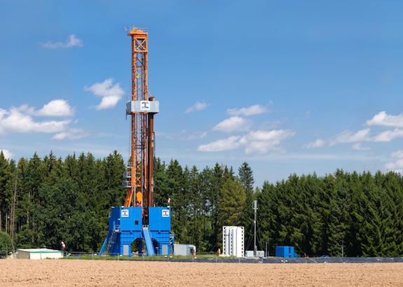
Hydraulic fracturing for natural gas may increase the risk of earthquake, a new study finds. Photo via Wikimedia Commons/Richard Bartz
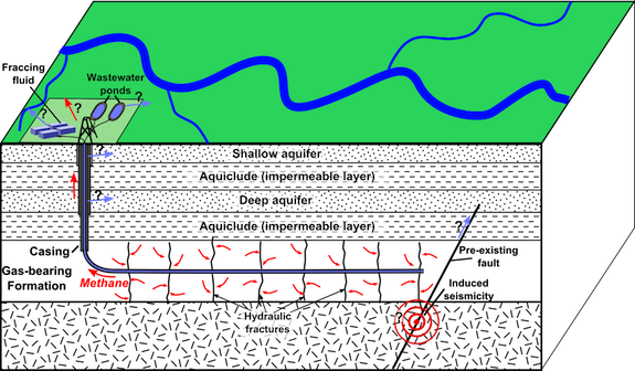
Hydraulic fracturing (a.k.a. “fracking”) recovery techniques for oil and natural gas are a controversial business. The practice—in which a mix of water, sand and chemicals is injected deep into bedrock at high pressure to create fractures, allowing gas and oil to flow upward—was developed in the late 1990s and has become more and more common across the United States over the past few years, opening up geologic areas such as the Bakken Shale in North Dakota and the Marcellus Shale in Pennsylvania, New York and West Virginia to dramatic increases in gas production.

On the one hand, proponents argue that hydraulic fracturing increases the amount of energy that can be economically produced in the United States, making oil and gas cheaper and reducing our dependency on foreign imports. Opponents, though, note that fracking causes dangerous chemicals to leach into groundwater, releases known carcinogens into the air and increases our contribution to climate change.

Alongside these observed problems, though, a different sort of worry has emerged: the idea that hydraulic fracturing can trigger an earthquake. Scientists have known for decades that injecting fluids into the earth could cause quakes, but we were uncertain just how much of an increase widespread fracking might cause. This past spring, USGS scientists decided that the recent dramatic increase in the number of small quakes in the United States is “almost certainly manmade,” but were unable to conclusively tie it to this particular activity.

Now, the evidence is starting to pile up. A study published today in the Proceedings of the National Academy of Sciences finds a correlation between dozens of small earthquakes in Texas’ Barnett Shale region—the site of intensive hydraulic fracturing activity—and the locations of injection wells used to dispose of the wastes of this process. ”You can’t prove that any one earthquake was caused by an injection well,” says Cliff Frohlich, the University of Texas geologist who conducted the study, “but it’s obvious that wells are enhancing the probability that earthquakes will occur.

To come to the finding, Frohlich analyzed two years’ worth of data from a network of extremely sensitive seismographs that was installed in the region in 2009. He discovered dozens of small earthquakes that had not been previously reported—and found that all 24 of the quakes for which he was able to establish an accurate epicenter occurred within two miles of an injection well.

One important distinction is that these wells were the disposal sites for waste fluids that had already used to fracture rock, rather than the original wells used to extract the gas. Although the actual gas extraction wells cause many microearthquakes by their very nature (they literally crack the bedrock to release gas and oil), these are far too small to be felt by humans or cause any damage. The fluid disposal wells, though, are more likely to cause earthquakes of significance, because they are sites of injection for a longer duration over time.

Image via Wikimedia Commons/Mike Norton
The waste fluids may trigger earthquakes by acting as lubricants in pre-existing faults deep underground, allowing masses of rock to slide past each other more easily and relieve built-up pressure. All of the wells that Frohlich found correlated with quakes were home to high rates of injection (more than 150,000 barrels of fluid per month). However, there were other wells in the area with similar rates of injection that did not correlate with increased seismic activity. ”It might be that an injection can only trigger an earthquake if injected fluids reach and relieve friction on a nearby fault that is already ready to slip,” explains Frohlich.

The good news is that all of these earthquakes were still relatively small, with magnitudes of less than 3.0 on the Richter scale, unlikely to cause any damage on the surface. Seismologists, though, are concerned that fluid injection could cause larger quakes if the fluid migrates into older, deeper rock formations beyond the local shale, which are home to larger fault lines. A number of earthquakes that occurred in Ohio last year, including one with a 4.0 magnitude, were linked to disposal of fracking fluids.

Frohlich notes that much more research is needed to help us understand exactly why some wells are more likely to cause earthquakes than others. For those already concerned about fracking, though, his new research adds another major concern to a growing list.