Mostrando entradas con la etiqueta Agricultura Intensiva. Mostrar todas las entradas

sábado, 1 de noviembre de 2014

Genetically Modified Organisms Risk Global Ruin, Says Black Swan Author

Experts have severely underestimated the risks of genetically modified food, says a group of researchers lead by Nassim Nicholas Taleb


It is 20 years since the FDA approved the Flavr Savr tomato for human consumption, the first genetically engineered food to gain this status. Since then, genetically modified food has become a significant part of the human diet in many parts of the world, particularly in the US. In 2013 roughly 85 per cent of corn and 90 per cent of soybeans produced in the US were genetically modified.

Given the ubiquity of this kind of foodstuff, you could be forgiven for thinking that the scientific debate over its safety has been largely settled. It is certainly true that a large number of scientists seem to take that view. In 2012, for example, the American Association for the Advancement of Science declared that genetically modified crops pose no greater risk than the same foods made from crops modified by conventional plant breeding techniques.

Today, Nassim Nicholas Taleb at New York University and a few pals say that this kind of thinking vastly underestimates the threat posed by genetically modified organisms. “Genetically modified organisms represent a public risk of global harm,” they say. Consequently, this risk should be treated differently from those that only have the potential for local harm. “The precautionary principle should be used to prescribe severe of limits on genetically modified organisms,” they conclude.

Taleb and co begin by making a clear distinction between risks with consequences that are local and those with consequences that have the potential to cause global ruin. When global harm is possible, an action must be avoided unless there is scientific near-certainty that it is safe. This approach is known as the precautionary principle.

The question, of course, is when the precautionary principle should be applied. Taleb and co begin by saying that their aim is to place the precautionary principle within a formal statistical structure that is grounded in probability theory and the properties of complex systems. “Our aim is to allow decision-makers to discern which circumstances require the use of the precautionary principle and in which cases evoking the precautionary principle is inappropriate.


lunes, 3 de marzo de 2014

El mapa que explica la deforestación en el mundo (y lo hace en tiempo real)

Varios organismos lanzan Global Forest Watch, una web que integra capas de datos para ver el estado de los bosques de todo el mundo

Los mapas los pone Google; las imágenes de satélite, la NASA; los datos, el World Resources Institute y otras agencias; y la capa de visualización, la empresa española Vizzuality

El recurso sirve para gobiernos, empresas, comunidades y para que cualquier ciudadano explore los cambios forestales casi según suceden, porque los datos se actualizan con frecuencia

 Global Forest Watch.


Mira el mapa. El rosa representa la masa forestal que ha desaparecido en España desde el año 2000. ¿Qué pasa en Galicia, que se ha perdido tanta? "Muy fácil: en Galicia se producen el 50% de incendios de España", responde Ángel Dorrio, técnico de Medioambiente de la asociación Amigos da Terra.

Las estadísticas del Ministerio de Agricultura y el mapa de España en Llamas confirman que Galicia es la comunidad en la que más hay. "Como ves, siempre aparece Galicia en rojo. Los datos son graves, llevamos más de cuarenta años con el mismo problema". Un caso reciente es el de las Fragas do Eume. Si hacemos zum, vemos con detalle la zona devastada. La captura de la izquierda es el parque entre 2005 y 2009; la de la derecha, entre 2005 y 2013. En abril de 2012, el incendio extinguió más de 750 hectáreas (que son las que aparecen en rosa).


Ahora mira esta otra imagen:


Es una de las áreas del mundo en la que más árboles desaparecen. Aunque la del Amazonas es la más sonada, lo de arriba es el zum sobre la región de Gran Chaco, entre el sur de Brasil, Argentina y Paraguay. ¿Qué pasa? ¿Por qué la deforestación allí es cuadrada? Se llama sojización y es el cultivo de soja. "En Argentina y Brasil ha crecido brutalmente. Sustituyen cultivos tradicionales por monocultivo y hay mucha deforestación", explica Tom Kucharz, de Ecologistas en Acción.

¿Y por qué soja? Es más barata ("es agricultura intensiva con muchísima tecnología y fertilizantes químicos para matar la mala hierba"), sus proteínas son perfectas para la ganadería industrial (la que usan las cadenas de comida rápida, por ejemplo) y se vende muy bien en los mercados internacionales.

Este gráfico muestra la evolución de su precio, que sólo de 2007 a 2008 subió un 86%. Como Kucharz, ecologistas e investigadores llevan años alertando sobre el problema y sus efectos económicos y sociales. También sobre los medioambientales, claro.

Pintar los cambios de los bosques

Galicia y sus incendios, y el Gran Chaco y su sojización son sólo dos de los casos de deforestación que hay en el mundo. Las imágenes para explicarlos las hemos sacado de Global Forest Watch, un proyecto del World Resources Institute presentado la semana pasada que, en forma de web, muestra el estado de los bosques del mundo.

Los mapas los pone Google; los datos de árboles desaparecidos y aparecidos e imágenes de satélite, organismos como la Universidad de Maryland o la NASA. Y la visualización de esos datos (o cómo ver, en una imagen, que los incendios forestales en Galicia o los cultivos de soja se cargan los bosques), la empresa española Vizzuality y su tecnología CartoDB (que en eldiario.es hemos utilizado, por ejemplo, para ver el tráfico ferroviario en España).

"Lo que nos gusta es contar historias y los mapas son un medio para ello", explica Carlos Matallín, uno de los desarrolladores que ha ‘pintado’ las capas de datos. "Tenemos datos muy ricos, importantes y validados, pero que no puedes tirar en crudo porque no se saca nada en claro. Puedes decir ‘sí, hay deforestación’. La parte bonita, interesante y compleja es cómo muestro estos datos a cualquier persona de forma amigable e intuitiva. Y con ello, contar, por ejemplo, la deforestación en un área protegida y cómo a través de las alertas se puede parar". ¿Alertas?


Si un árbol cae y nadie lo escucha, ¿hace ruido?

Un problema de la deforestación es que cuando se detecta (cuando el árbol cae en mitad del bosque) suele ser tarde para pararla. Por eso la novedad de Global Forest Watch, que lleva dos años en desarrollo y del que ha habido prototipos previos, es el tiempo real: los datos que integra no sólo son de muy buena calidad (aquí explican de dónde proviene cada set de datos y cómo se ha tomado), sino que en muchos casos se actualizan diaria o mensualmente. También la posibilidad de delimitar áreas, guardarlas y poner alertas que te avisen si 'algo' cambia (si algún árbol cae en mitad del bosque).

.

"La página dice: 'near real time' (casi en tiempo real). La capa de fuegos, por ejemplo, se puede tener con hasta un día de diferencia. En cada capa están explicadas la resolución de los datos y la periodicidad con la que se actualizan", cuenta Matallín. Las capas más importantes son las de Forest Change (el cambio en los bosques, que dentro de la web está en la columna de la izquierda). "Queremos saber cómo está cambiando el bosque y eso viene explicado ahí. El resto de las capas (biodiversidad, masa forestal, zonas intactas o protegidas) ayudan al análisis".

Haciendo zoom, activando y desactivando capas de datos, puedes encontrar historias de deforestación o reforestación. Además de los incendios gallegos o sojización, en este post hay otros nueve ejemplos para entender lo que pasa en los bosques del mundo.

Rompiendo la barrera entre la ciencia y las personas

Más allá del ‘wow, qué mapa tan vistoso’, la herramienta es útil para muchos agentes. "Sirve para diferentes tipos de personas que quieran trabajar con los datos. Agencias gubernamentales, o no, que quieran controlar la deforestación, grupos indígenas que quieran saber qué está pasando con su tierra o empresas que quieren asegurarse de que su cadena de distribución cumple con los compromisos", precisa Matallín.

"Digamos Unilever o Nestlé, que son empresas que han dado su nombre. Nestlé tiene proveedores que están explotando un área. Ellos pueden ir a esa zona, hacer un análisis y confirmar que lo que les han dicho sus proveedores coincide con lo que ellos ven a través de la web".

Y más allá de gobiernos, empresas y grandes organizaciones, el objetivo de Global Forest Watch es llegar a la gente: con la posibilidad de enviar historias para explicar, con fotos, palabras y ejemplos, qué pasa en los bosques del mundo (¿hay un incendio en Valencia?, ¿en la isla de Sumatra? Envíaselo para que aparezca sobre el mapa) y que cualquier ciudadano lo explore.

"Con los datos en números no haces nada. Con esto acercas un poco más, o ayudas a romper la barrera que hay entre la ciencia y las personas. Que, al fin y al cabo, es lo importante y realmente crucial de este proyecto".

ORIGINAL: El Diario (España)
Analía Plaza
02/03/2014

lunes, 17 de junio de 2013

28,000 Rivers Disappeared in China: What Happened?

Apr 29 2013

Government officials say it's been caused by statistical inaccuracies and climate change. But is that the whole story?
Reuters
As recently as 20 years ago, there were an estimated 50,000 rivers in China, each covering a flow area of at least 60 square miles. But now, according to China's First National Census of Water, more than 28,000 of these rivers are missing. To put this number into context, China's lost rivers are almost equivalent, in terms of basin area, to the United States losing the entire Mississippi River.

Why have these rivers "vanished" from the maps and national records?

Official explanations from the Chinese government have attributed the significant reduction to statistical discrepancies, water and soil loss, and climate change.

"The disparity in numbers was caused mainly by inaccurate estimates in the past, as well as climate change and water and soil loss. Due to limited technology in the past, the previous figures were estimated using incomplete topographic maps dating back to the 1950s," said Huang He, China's Deputy Director of the Ministry of Water Resources, in an interview with the South China Morning Post.

While this explanation seems plausible, Chinese web users, an active and formidable force for raising environmental issues with the Chinese government, are not satisfied. One user named Yami Laoliu, writing on the popular Chinese social media platform Sina Weibo, voiced skepticism: "I am surprised to learn that 28,000 rivers have already disappeared in the map. Is it natural disaster? Or man-made mistake? I think both played a role, but it was mainly a man-made mistake."

Peter Gleick, president of the Pacific Institute and a leading water expert agrees: "Climate change is a real threat to the world's resources, and we already see evidence of impacts on water availability, quality, and extreme events. But the water challenges in China are far greater than just climate change," he said.

Pinning the rivers' disappearance on climate change is politically palatable right now, and the human origin of global warming is not controversial in China. But in an unusual twist, blaming climate change allows officials to absolve themselves of the poor management, governance, lack of groundwater extraction controls, and rapid development that are more likely culprits for the river's disappearances.

"As China's population and economy have rapidly grown, the country has experienced serious degradation of its water resources, including massive overuse and contamination," Gleick said. "The 'disappearance' of major rivers and streams is far more likely to be directly connected to uncontrolled and unsustainable extraction of water for industry and agriculture, though climate change may play a greater role in the future."

***

The past 30 years in which these rivers vanished have coincided with a phase of rapid industrialization and urban growth in China. From 1990 to 2000, urban areas expanded by more than 5,000 square miles, an area the size of Puerto Rico, and the expanding economy has correspondingly strained water and energy resources. In Yale University's 2012 Environmental Performance Index, China is one of the worst performers (ranked 116 out of 132 countries) with respect to its performance on changes in water quantity due to consumption, including industrial, agricultural, and household uses.

Poor management of water resources has also exacerbated the situation. The main water resource law in China only requires permits for groundwater extractions for "large-scale" projects. The lack of specificity in this language has led to what Gleick says is substantial overdraft of groundwater throughout the country. Weak water governance also caused last September's red water flow in to the Yangtze River, an occurrence that left even Chinese officials perplexed.

What about the statistical discrepancies that the government says could have factored in to the rivers' disappearance? While some updates to river classification are plausible, cartography and mapping techniques have been very sophisticated in China for many years. One user on Sina Weibo tweeted an old map of waterways for Qingdao, showing abundant waterways in considerable detail. The maps are accurate and Qingdao's rivers have not been wiped away by "improved surveying methods" -- they have simply been converted into Qingdao's sprawling roadways, said one of the city's urban historians.

So why is the Chinese government blaming only climate change and statistical inaccuracies? Climate change is an easy and popular scapegoat and allows the government to save face by pinning the disappearance on natural causes rather than anthropogenic (and arguably preventable) ones.

However, as the Chinese online reaction demonstrates in this case and in recent air pollution events, the Chinese public may not be as willing to accept such a backseat approach to environmental management. Given the current state of the waterways and growing demand for water in China, authorities would be better served by thoroughly examining the root causes of the challenge and striving to be more transparent about both the certainties and the uncertainties surrounding the issue.

lunes, 13 de mayo de 2013

Peru says no to GMO

ORIGINAL: CSMonitor
By Annie Murphy
April 25, 2013

Peru is the first country in the Americas to ban genetically modified foods, putting its food policy closer to that of Europe, than the United States or many of its South American neighbors.

A man drags a cart loaded with vegetables in downtown Lima, Peru, Wednesday.  Mariana Bazo/Reuters
LIMA, PERU
There isn’t much local Chef Pedro Miguel Schiaffino won’t eat. His highly accliamed Amaz restaurant is devoted to finding and using Amazonian food native to the country, like a 600-pound freshwater fish or a little-known fruit nicknamed “cannonball” that tastes like a cross between a guava, coconut, and melon.

But a year ago Mr. Schiaffino stopped eating supermarket tomatoes.

Even though Peru is the birthplace of the crop, it’s difficult to find anything other than hard, pale Roma tomatoes in supermarkets, and Schiaffino says that worried him.

They’re a big monoculture, which is why people usually end up using [genetically modified organisms] GMOs. Because when you have monocultures, the crops end up getting diseases, and you have to look for these extreme ways to fix them,” he says.

Peru was the cradle of the Inca Empire, and today it’s home to many crops indigenous to the Americas. It has 400 varieties of potato alone, and a geography that allows farmers to grow almost anything.

It's also the only country in the Americas to put a 10-year ban on genetically modified food, with a law that was first introduced in 2011, and went into effect at the end of last year. Its basic intention, say Schiaffino and others, is to protect Peru’s biodiversity, as well as the practices that have kept it intact for so long

In the end, it’s not a law that’s ‘against’ anything,” says Antonietta Gutierrez, a biologist at Peru’s National Agrarian University. “This is a law in favor of biosecurity. The idea is that there should be a responsible way of using technology, so that it helps us develop resources – and at the same time, doesn’t destroy what we already have."

GMOs are organisms that have been altered via genetic engineering – and this can mean anything from bacteria, to animals, and plants. Supporters praise the ability of engineers to do things like create plants resistant to pests and drought, or ones that have higher yields. Yet those wary of GMO crops worry about food safety, a lack of longterm research, and the potential for contaminating and even wiping out non-GMO species.

For the past few decades, Profesor Gutierrez has kept a packed schedule, doing experiments in the test fields and laboratories of the agrarian university, and as a proponent of laws to regulate GMO crops.

There aren’t yet long term studies of GMOs,” says Gutierrez in a spartan concrete and linoleum lab just outside the capital. “You can’t measure their real effects in five, 10, or even 20 years. It takes more time to observe those effects, especially when we’re talking about entire ecosystems.

Peru's new law puts its food policy closer to that of Europe, than to that of the United States or many of its South American neighbors. While genetically modified species can still be tested in controlled lab settings, as of December 2012, they can’t be planted or set free, and GMO seeds are barred from entering the country. Both activists and many scientists consider this a coup.

GMOs produced outside the country, however, are still present in products sold in supermarkets. A law requiring products containing GMOs to be labeled was passed in 2011 – but terms and regulations were never set. According to a study done by the Peruvian Association of Consumers and Users, of 13 basic products bought and tested for the presence of GMOs, 10 tested positive.

Activists say this is all the start of a long fight. 

'Ancient culture'
Uldarico Reyes Roldán has been working at the popular Madre Natura natural food market in Lima’s Miraflores neighborhood since the store opened 30 years ago. He jokes that a lot of the people who come into the store “want to stay thin,” and that if healthy food also happens to be organic and GMO-free, they just see it as an added bonus.

But seriously, for instance, take a look at this,” he says, pawing through a wooden cabinet filled with bags of freshly milled grain. He holds up a small sack of coarsely ground wheat the color of tree bark, explaining that it’s a Peruvian variety, unaltered, and free of pesticides. “People taste the difference. It’s nuttier, more malty. They come back asking for this stuff. Not some stuff that comes from who knows where.” 

Many of these products have been around for centuries—since the Incas, and earlier.

Our ancient cultures knew how to do this,” says Schiaffino, the chef. “They grew crops together, in terraces, with the seasons, with the rain, and natural irrigation. I think they had more knowledge about crops and cultivation and farming than we have now.”

Back in the dining room of Amaz, one of Schiaffino’s two restaurants, an enormous mural of a tropical serpent covers the wall behind him. It’s done in tiny iridescent beads, meant to evoke the indigenous, plant-based hallucinogen ayahuasca.

Schiaffino’s restaurants function according to the logic that monoculture and the implementation of GMOs is “going against nature. What nature tells you is that you have to have different plants and different animals around.” He relies on small producers and foragers, many of whom are from indigenous groups that have long acted as stewards of Peru’s biodiversity. A few of those producers even introduced him to a tomato native to the Amazon.

It’s an heirloom seed that’s stayed in the Amazon. It looks like a bull’s heart, but smaller. Very tasty.

Schiaffino says the flavor of a good tomato is all about the smell. 

Like some humidity, with earth, along with a green scent. You can tell it’s just-picked," he says. "The supermarket tomatoes have no smell. 

"Sometimes we don't think to appreciate the possibility of doing this another way."

miércoles, 1 de agosto de 2012

Farming and biodiversity can coexist, say Stanford researchers

ORIGINAL: Stanford News
BY MAX MCCLURE

Although bird species disappear with intensive agriculture, research in Costa Rica shows that forest intermingled with cultivated land rescues biodiversity.

The Yellow-billed Cacique will likely persist and thrive in low-intensity agriculture.
Photo: 
Daniel Karp 
To keep up with projected demand, farming output will need to double in the next few decades. This inconvenient fact is bad news for the environment as a whole, and biodiversity in particular. Large-scale, high-intensity agricultural production, scientists say, dramatically reduces variation between bird communities of different areas.

But Stanford scientists say there may be a way to increase agricultural land without substantially impacting biodiversity.

A new paper by biology graduate student Daniel Karp, with Stanford biology professors and Stanford Woods Institute for the Environment fellows Gretchen Daily and Paul Ehrlich, shows that low-intensity tropical agriculture can maintain regional species differences at levels similar to those of intact forest. The study appears in today's issue of the journal Ecology Letters.

"It's one way of addressing a basic question," said Karp. "How can we feed people while preserving biodiversity?"

Animal farm
Karp was interested in "beta-diversity" – not the sheer number of species present in a region, but the differences between the sets of species that live in two different regions.

"The tropics have many more species total, which people know," said Karp. "But they also have a lot more beta-diversity," making Costa Rica an ideal place to study the ecological effects of agriculture.

The researchers found that "specialist" species that are adapted to particular food sources and environmental conditions disappear as land is converted to intensive agriculture. The process leaves the same population of "generalist" species in most converted lands, decreasing beta-diversity between formerly distinct regions.

"To a bird, high-intensity production is basically going to look the same no matter where it is," said Karp. "A melon plantation in the north of Costa Rica is going to look the same as a pineapple plantation in the south."

But agriculture on a small scale, or agriculture that leaves trees or other native species intermingled with crops, retains forest-like levels of beta-diversity.

The paper's data came from 10 years' worth of bird species monitoring from ornithologist Jim Zook, working with Daily and Stanford's Center for Conservation Biology. His unique transects through different plots of Costa Rican land – some forested, some under heavy agricultural use and some in between – and years of patient monitoring have provided insight into the impacts of alternative agricultural strategies.
Services rendered

In a previous paper from the team, Zook's data showed that careful stewardship may allow agriculture and biodiversity to coexist and suggested that preservation may not need to be an all-or-nothing proposition.

Farms, for instance, rely on birds for pollination, fruit dispersal and pest control. More generally, the presence of intact, biodiverse lands near a farm guarantees society certain natural benefits, including water purification and nutrient cycling.

"If these birds are locked up in a preserve far from humans, you're not going to get any of those services as a farmer," Karp said.

Costa Rica is already one of the first nations to adopt a "payments for ecosystem services," or PES, scheme. Acknowledging the value of keeping undeveloped land near agricultural areas, the policy compensates farmers for leaving part of their lands out of production. The new biodiversity finding offers further support for the practice, as Daily has addressed previously.

"Reducing pressure from population growth and consumption are crucial for achieving sustainability," Karp said. "But we also need to start thinking about making smarter societies – in which we can grow food and preserve ecosystem services and species at the same time."
Media Contact

Daniel Karp, Biology: dkarp@stanford.edu

Max McClure, Stanford News Service: (650) 725-6737, maxmc@stanford.edu

martes, 29 de mayo de 2012

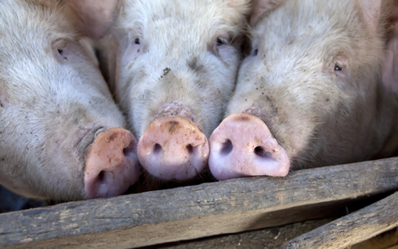
Factory Farms Produce 100 Times More Waste than U.S. Population

ORIGINAL: Naturalsociety.com
Mike Barrett. NaturalSociety
May 29, 2012


If you thought you were a major contributor to pollution, just wait until you hear this. Factory farms produce 100 times more waste than every single person in the United States combined. The amount of waste produced by these factories is in such mass quantities that it is virtually impossible to clean up properly. Much of this waste is dumped into the water supply, drastically increasing overall water pollution as well as contributing to the pollution found in drinking water.

Back in 2008 the Environmental Protection Agency (EPA) made a decision that affected many factory farms. They stated that any confined animal feeding operation (CAFO), also known as factory farms, “designed, constructed, operated, and maintained in a manner such that the CAFO will discharge” animal waste must apply for a National Pollutant Discharge Elimination System (NPDES) permit under the Clean Water Act. The livestock industry ridiculed this notion.

There have been past rulings concerning this issue that forced farmers to have a permit to discharge waste and to have a set plan as to how the waste would be discharged, or they would face civil or criminal penalties. The 2008 ruling went further with the issue, putting even more criteria in place to follow.

A ruling on Tuesday, March 15, 2011 by the Fifth Circuit Court of Appeals, however, ruled that the EPA has no right to require CAFOs to apply for permits unless they actually discharge waste. But if a CAFO does in fact discharge waste, the EPA can then require that CAFO to apply for a permit.

Nutrients in animal waste cause something known as algal blooms, which use up oxygen in the water and effectively cause a lack of oxygen for aquatic life to survive. These lifeless areas are called “dead zones”. The most notorious of dead zones can be found in the Gulf of Mexico, where it extended a record 8,500 square miles during the summer of 2002 and stretched over 7,700 square miles during summer of 2010, and is always fluctuating. Ammonia, a toxic form of nitrogen released during waste disposal, can be carried via air over 300 miles before being dumped back onto the ground or into the water, where it causes algal blooms and fish kills.

The past laws set in place forced CAFOs to apply for a permit and create a plan to handle the massive amount of waste the animals would inevitably generate. With this law changing and lowering the standards at which factory farms are run by, CAFO’s will be able to wait until the last minute before they decide to dump the waste. Despite the fact that the EPA will be able to penalize them for such actions, the CAFO’s will already have done the damage to the environment by ridding their land of millions of gallons of manure.

The simple fact is that factory farms are causing problems, and are still being widely used today.
  • The number of hog farms in the United States has dropped from 650,000 to 71,000 over the past 30 years, however, the number of hogs remains nearly the same.
  • In 1999, only 2% of hog farms in the U.S. accounted for more than 46% of the total number of hogs, as reported by U.S. Department of Agriculture.
  • 10 total companies produce over 90% of the nation’s poultry.
Additional sources: