ORIGINAL: EFE CNet en Español

Mostrando entradas con la etiqueta Curiosity. Mostrar todas las entradas
Mostrando entradas con la etiqueta Curiosity. Mostrar todas las entradas
martes, 16 de junio de 2015

miércoles, 10 de diciembre de 2014
NASA’s Curiosity Rover Finds Clues to How Water Helped Shape Martian Landscape
 |
This illustration depicts a lake of water partially filling Mars' Gale Crater, receiving runoff from snow melting on the crater's northern rim.
Image Credit: NASA/JPL-Caltech/ESA/DLR/FU Berlin/MSSS
|
 |
This evenly layered rock photographed by the Mast Camera (Mastcam) on NASA's Curiosity Mars Rover on Aug. 7, 2014, shows a pattern typical of a lake-floor sedimentary deposit not far from where flowing water entered a lake.
Image Credit: NASA/JPL-Caltech/MSSS
|
 |
This image from Curiosity's Mastcam shows inclined beds of sandstone interpreted as the deposits of small deltas fed by rivers flowing down from the Gale Crater rim and building out into a lake where Mount Sharp is now. It was taken March 13, 2014, just north of the "Kimberley" waypoint.
Image Credit: NASA/JPL-Caltech/MSSS
|
 |
This March 25, 2014, view from the Mastcam on NASA's Curiosity Mars rover looks southward at the Kimberley waypoint. In the foreground, multiple sandstone beds show systematic inclination to the south suggesting progressive build-out of delta sediments in that direction (toward Mount Sharp).
Image Credit: NASA/JPL-Caltech/MSSS
|
 |
This image shows inclined beds characteristic of delta deposits where a stream entered a lake, but at a higher elevation and farther south than other delta deposits north of Mount Sharp. This suggests multiple episodes of delta growth building southward. It is from Curiosity's Mastcam.
Image Credit: NASA/JPL-Caltech/MSSS
|
 |
This image shows an example of a thin-laminated, evenly stratified rock type that occurs in the "Pahrump Hills" outcrop at the base of Mount Sharp on Mars. The Mastcam on NASA's Curiosity Mars rover acquired this view on Oct. 28, 2014. This type of rock can form under a lake.
Image Credit: NASA/JPL-Caltech/MSSS
|
Observations by NASA’s Curiosity Rover indicate Mars' Mount Sharp was built by sediments deposited in a large lake bed over tens of millions of years.
This interpretation of Curiosity’s finds in Gale Crater suggests ancient Mars maintained a climate that could have produced long-lasting lakes at many locations on the Red Planet.
"If our hypothesis for Mount Sharp holds up, it challenges the notion that warm and wet conditions were transient, local, or only underground on Mars,” said Ashwin Vasavada, Curiosity deputy project scientist at NASA's Jet Propulsion Laboratory in Pasadena. “A more radical explanation is that Mars' ancient, thicker atmosphere raised temperatures above freezing globally, but so far we don't know how the atmosphere did that."
Why this layered mountain sits in a crater has been a challenging question for researchers. Mount Sharp stands about 3 miles (5 kilometers) tall, its lower flanks exposing hundreds of rock layers. The rock layers – alternating between lake, river and wind deposits -- bear witness to the repeated filling and evaporation of a Martian lake much larger and longer-lasting than any previously examined close-up.
"We are making headway in solving the mystery of Mount Sharp," said Curiosity Project Scientist John Grotzinger of the California Institute of Technology in Pasadena, California. "Where there's now a mountain, there may have once been a series of lakes."
Curiosity currently is investigating the lowest sedimentary layers of Mount Sharp, a section of rock 500 feet (150 meters) high dubbed the Murray formation. Rivers carried sand and silt to the lake, depositing the sediments at the mouth of the river to form deltas similar to those found at river mouths on Earth. This cycle occurred over and over again.
"The great thing about a lake that occurs repeatedly, over and over, is that each time it comes back it is another experiment to tell you how the environment works," Grotzinger said. "As Curiosity climbs higher on Mount Sharp, we will have a series of experiments to show patterns in how the atmosphere and the water and the sediments interact. We may see how the chemistry changed in the lakes over time. This is a hypothesis supported by what we have observed so far, providing a framework for testing in the coming year."
After the crater filled to a height of at least a few hundred yards and the sediments hardened into rock, the accumulated layers of sediment were sculpted over time into a mountainous shape by wind erosion that carved away the material between the crater perimeter and what is now the edge of the mountain.
On the 5-mile (8-kilometer) journey from Curiosity’s 2012 landing site to its current work site at the base of Mount Sharp, the rover uncovered clues about the changing shape of the crater floor during the era of lakes.
"We found sedimentary rocks suggestive of small, ancient deltas stacked on top of one another," said Curiosity science team member Sanjeev Gupta of Imperial College in London. "Curiosity crossed a boundary from an environment dominated by rivers to an environment dominated by lakes."
Despite earlier evidence from several Mars missions that pointed to wet environments on ancient Mars, modeling of the ancient climate has yet to identify the conditions that could have produced long periods warm enough for stable water on the surface.
NASA's Mars Science Laboratory Project uses Curiosity to assess ancient, potentially habitable environments and the significant changes the Martian environment has experienced over millions of years. This project is one element of NASA's ongoing Mars research and preparation for a human mission to the planet in the 2030s.
"Knowledge we're gaining about Mars' environmental evolution by deciphering how Mount Sharp formed will also help guide plans for future missions to seek signs of Martian life," said Michael Meyer, lead scientist for NASA's Mars Exploration Program at the agency's headquarters in Washington.
JPL, managed by the California Institute of Technology, built the rover and manages the project for NASA's Science Mission Directorate in Washington.
For more information about Curiosity, visit:
and
ORIGINAL: NASA
December 8, 2014
lunes, 1 de abril de 2013
Curiosity's Hit-and-Run Leads to Another Martian Discovery
ORIGINAL: The Atlantic
Behold: "One of the whitest things" we've seen on the Red Planet
 |
| The white planet? The "Tintina" rock Curiosity cut through in its travels (NASA/JPL-Caltech) |
Back in January, the Mars Curiosity rover did what it was built to do: It plowed over some rock. On this particular day, however, one of the rocks the rover roved over broke apart -- revealing, in pictures beamed back to Earth, a shiny-white interior that stands in sharp relief against the dusty-red Martian landscape. "This is one of the brightest and whitest things we've seen with the Mastcam [Curiosity's camera] at the Gale Crater site," Caltech's Melissa Rice said of the object.
Scientists have since been analyzing information about the mystery rock -- nicknamed, awesomely, "Tintina" -- and today, at the annual Lunar and Planetary Science Conference (LPSC) in Texas, they've released their findings.
And those findings, like so many of the things we learn about Mars with the help of our little robotic liaison, represent both "discovery" and "mystery." We know, for example, that the chalky-white rock is roughly 1.2 inches by 1.6 inches -- the size, basically, of a large marble. The images of Tintina's seam would also seem to indicate the presence of hydrated minerals -- the kind so familiar to us here on Earth. Which might also indicate the presence (or, the erstwhile presence) of water. And which offers yet more evidence that the area Curiosity is roving -- Yellowknife Bay -- was once home to the life-friendly liquid.
As Rice explained to the BBC: "What Mastcam is seeing is water that is bound in the mineral structure of the rocks. This water is left over from a previous wet era and is now trapped and preserved in these hydrated minerals."
The Tintina announcement comes hot on the heels of one of Curiosity's biggest findings: that Mars boasts environmental conditions that could once have supported life as we know it. And Curiosity has observed, as well, what scientists believe to be the remains of an ancient riverbed near its landing site at the Gale Crater. "The picture that seems to be emerging," the BBC put it in a report from the LPSC, "is one where sediments were transported downhill from the eroding crater rim into a network of streams that then flowed into a lake environment represented by the mudstone drilled by Curiosity." And it's a picture made a little clearer by Curiosity's serendipitous excavation. Mars, site of an ancient Slip 'n Slide! Just one more piece of information about the Red Planet, brought to you by a white rock.
miércoles, 13 de marzo de 2013
NASA Rover Finds Conditions Once Suited for Ancient Life on Mars
ORIGINAL: NASA
March 12, 2013
PASADENA, Calif. -- An analysis of a rock sample collected by NASA's Curiosity rover shows ancient Mars could have supported living microbes.
Scientists identified sulfur, nitrogen, hydrogen, oxygen, phosphorus and carbon -- some of the key chemical ingredients for life -- in the powder Curiosity drilled out of a sedimentary rock near an ancient stream bed in Gale Crater on the Red Planet last month.
"A fundamental question for this mission is whether Mars could have supported a habitable environment," said Michael Meyer, lead scientist for NASA's Mars Exploration Program at the agency's headquarters in Washington. "From what we know now, the answer is yes."
Clues to this habitable environment come from data returned by the rover's Sample Analysis at Mars (SAM) and Chemistry and Mineralogy (CheMin) instruments. The data indicate the Yellowknife Bay area the rover is exploring was the end of an ancient river system or an intermittently wet lake bed that could have provided chemical energy and other favorable conditions for microbes. The rock is made up of a fine-grained mudstone containing clay minerals, sulfate minerals and other chemicals. This ancient wet environment, unlike some others on Mars, was not harshly oxidizing, acidic or extremely salty.
The patch of bedrock where Curiosity drilled for its first sample lies in an ancient network of stream channels descending from the rim of Gale Crater. The bedrock also is fine-grained mudstone and shows evidence of multiple periods of wet conditions, including nodules and veins.
Curiosity's drill collected the sample at a site just a few hundred yards away from where the rover earlier found an ancient streambed in September 2012.
"Clay minerals make up at least 20 percent of the composition of this sample," said David Blake, principal investigator for the CheMin instrument at NASA's Ames Research Center in Moffett Field, Calif.
These clay minerals are a product of the reaction of relatively fresh water with igneous minerals, such as olivine, also present in the sediment. The reaction could have taken place within the sedimentary deposit, during transport of the sediment, or in the source region of the sediment. The presence of calcium sulfate along with the clay suggests the soil is neutral or mildly alkaline.
Scientists were surprised to find a mixture of oxidized, less-oxidized, and even non-oxidized chemicals, providing an energy gradient of the sort many microbes on Earth exploit to live. This partial oxidation was first hinted at when the drill cuttings were revealed to be gray rather than red.
"The range of chemical ingredients we have identified in the sample is impressive, and it suggests pairings such as sulfates and sulfides that indicate a possible chemical energy source for micro-organisms," said Paul Mahaffy, principal investigator of the SAM suite of instruments at NASA's Goddard Space Flight Center in Greenbelt, Md.
An additional drilled sample will be used to help confirm these results for several of the trace gases analyzed by the SAM instrument.
"We have characterized a very ancient, but strangely new 'gray Mars' where conditions once were favorable for life," said John Grotzinger, Mars Science Laboratory project scientist at the California Institute of Technology in Pasadena, Calif. "Curiosity is on a mission of discovery and exploration, and as a team we feel there are many more exciting discoveries ahead of us in the months and years to come."
Scientists plan to work with Curiosity in the "Yellowknife Bay" area for many more weeks before beginning a long drive to Gale Crater's central mound, Mount Sharp. Investigating the stack of layers exposed on Mount Sharp, where clay minerals and sulfate minerals have been identified from orbit, may add information about the duration and diversity of habitable conditions.
NASA's Mars Science Laboratory Project has been using Curiosity to investigate whether an area within Mars' Gale Crater ever has offered an environment favorable for microbial life. Curiosity, carrying 10 science instruments, landed seven months ago to begin its two-year prime mission. NASA's Jet Propulsion Laboratory in Pasadena, Calif., manages the project for NASA's Science Mission Directorate in Washington.
For more about the mission, visit: http://www.jpl.nasa.gov/msl , http://mars.jpl.nasa.gov/msl/ and http://www.nasa.gov/msl . You can follow the mission on Facebook and Twitter at: http://www.facebook.com/marscuriosity and http://www.twitter.com/marscuriosity
DC Agle 818-393-9011
Jet Propulsion Laboratory, Pasadena, Calif.
agle@jpl.nasa.gov
Dwayne Brown 202-358-1726
NASA Headquarters, Washington
Dwayne.c.brown@nasa.gov
 |
| Two Different Aqueous Environments |
This set of images compares rocks seen by NASA's Opportunity rover and Curiosity rover at two different parts of Mars. On the left is " Wopmay" rock, in Endurance Crater, Meridiani Planum, as studied by the Opportunity rover.
 |
| First Curiosity Drilling Sample in the Scoop. This image from NASA's Curiosity rover shows the first sample of powdered rock extracted by the rover's drill. Image credit: NASA/JPL-Caltech/MSSS |
 |
| Minerals at 'Rocknest' and 'John Klein' |
This side-by-side comparison shows the X-ray diffraction patterns of two different samples collected from the Martian surface by NASA's Curiosity rover. These images, made from data obtained by Curiosity's Chemistry and Mineralogy instrument (CheMin), show the patterns obtained from a drift of windblown dust and sand called "Rocknest" and from a powdered rock sample drilled from the "John Klein" bedrock.
The presence of abundant clay minerals in the John Klein drill powder and the lack of abundant salt suggest a fresh water environment. The presence of calcium sulfates rather than magnesium or iron sulfates (as found at Meridiani Planum by NASA's Mars Exploration Rover Opportunity) suggests a neutral to mildly alkaline pH environment. The Rocknest sand shadow mineralogy suggests a dry, aeolian (wind-shaped) environment with low water activity. The John Klein mineralogy suggests a lacustrine (lakebed) environment with high water activity.
As seen on the left, the Rocknest data reveal abundant plagioclase feldspar, pyroxene and olivine minerals. The data also indicate reveal small amounts of magnetite and anhydrite. In addition, the Rocknest sample contains 25 to 35 percent amorphous, or non-crystalline, material.
X-ray diffraction analysis of the John Klein drill powder reveals abundant phyllosilicate (a class of clay minerals called smectites that form by the action of relatively pure and neutral pH water on source minerals), plagioclase feldspar, pyroxene, magnetite and olivine. Alternatively, the clay minerals could have been transported by water from sources higher up the sediment fan to form the John Klein mineral assemblage. The region of the pattern indicating the phyllosilicates is labeled in the annotated version of this image. The data also show minor amounts of anhydrite and bassanite. The John Klein sample also contains about 20 percent amorphous material.
 |
| NASA's Jet Propulsion Laboratory, a division of Caltech in Pasadena, manages the project for NASA's Science Mission Directorate, Washington, and built Curiosity and CheMin. |
An Earth Analog to Mars' Yellowknife Bay. This set of images shows a modern terrestrial analog to the "Yellowknife Bay" area that NASA's Curiosity rover is exploring. At left is a sampling pit exposing clay-bearing lake sediments, deposited in a basaltic basin in southern Australia. Image Credit: NASA/JPL-Caltech/Ames
 |
| Location of John Klein Drill Site |
 |
| Studying Habitability in Ancient Martian Environments |
This set of images shows the results from the rock abrasion tool from NASA's Mars Exploration Rover Opportunity (left) and the drill from NASA's Curiosity rover (right). Note how the rock grindings from Opportunity are brownish red, indicating the presence of hematite, a strongly oxidized iron-bearing mineral. Such minerals are less supportive of habitability and also may degrade organic compounds. The diameter of the abraded circle is 1.8 inches (4.5 centimeters). The image was cropped from an image
taken on Sol 35 (the 35th Martian day of Opportunity's operations, or Feb. 28, 2004, on Earth) by Opportunity's panoramic camera at a target called "Guadalupe" inside Eagle Crater.
On the right is the hole produced by Curiosity during the first drilling into a rock on Mars to collect a sample from inside the rock. In this case, the rock produced gray tailings -- not red -- suggesting the presence of iron that is less oxidized. One possibility is magnetite, which was determined to be present by Curiosity's Chemistry and Mineralogy instrument. Magnetite has less oxygen than hematite and would be more compatible with habitability and the preservation of organics, all other factors being equal. These other factors would include the primary concentration of organics in the sedimentary environment, in addition to later exposure of rock to surface radiation. The diameter of the hole is 0.63 inch (1.6 centimeters), which is approximately 1/3 of that on the left-hand image. The image was cropped fromPIA16726. It was taken on Sol 182 (the 182d Martian day of Curiosity's operations, or Feb. 8, 2013, on Earth) by the Mars Hand Lens Imager on Curiosity's arm after that day's drilling at a target rock called "John Klein."
JPL manages the Mars Science Laboratory/Curiosity for NASA's Science Mission Directorate in Washington. The rover was designed, developed and assembled at JPL, a division of the California Institute of Technology in Pasadena.
For more about NASA's Curiosity mission, visit: http://www.jpl.nasa.gov/msl, http://www.nasa.gov/mars, andhttp://mars.jpl.nasa.gov/msl.
 |
| Major Gases Released from Drilled Samples of the 'John Klein' Rock |
An analysis of a drilled rock sample from NASA's Curiosity rover shows the presence of water, carbon dioxide, oxygen, sulfur dioxide, and hydrogen sulfide released on heating. The results analyzing the high temperature water release are consistent with smectite clay minerals.
Curiosity's Sample Analysis at Mars (SAM) instrument suite conducted the analysis. The first step in the analysis of a portion of this drilled sample was to heat the sample in a quartz oven to 1,535 degrees Farenheit (835 degrees Celsius) and analyze the gases as they were released using SAM's quadrupole mass spectrometer (QMS). The signatures of more than five hundred mass values were sampled during the heating of this drilled sample and analyzed by the QMS. Five are shown in the graph. These traces are diagnostic of water, carbon dioxide, oxygen, and two forms of sulfur (sulfur dioxide, the oxidized form, and hydrogen sulfide, the reduced form) measured by the QMS.
The second step in the analysis was to send a portion of the gas released from the sample to the tunable laser spectrometer (TLS) to measure isotopes of carbon, oxygen and hydrogen, in both water and carbon dioxide. The ratio of deuterium (a heavy form of hydrogen) to the lighter, more abundant form of hydrogen was lower than the deuterium-to-hydrogen ratio measured by SAM in more loosely bound water in the sample from the "Rocknest" drift. The high deuterium-to-hydrogen ratio in water in the Mars atmosphere is a signature of the lighter hydrogen more rapidly escaping to space over geological time. Therefore, measuring the deuterium-to-hydrogen in water released from rocks is one tool that can be used to explore ancient reservoirs of water on Mars.
The third step in the analysis was to inject gas trapped during the heating process into SAM's third instrument, the gas chromatograph. Individual compounds separate out in time in a long capillary column in this instrument and are then introduced into the QMS. The gas chromatograph mass spectrometer is a prime tool in the SAM search for organic compounds.
The ratio of reduced species to oxidized species released by the SAM ovens is significantly higher in this drilled bedrock than in the previously scooped dust samples. These results indicate a significant amount of available chemical energy because oxidized and less oxidized versions of molecules are present. This result, combined with suitable aqueous conditions at this site in the distant past, made this a potentially habitable environment.
The SAM analysis was conducted on Sol 200 (the 200th Martian day of Curosity's operations, which was Feb. 27, 2013, on Earth).
JPL manages the Mars Science Laboratory/Curiosity for NASA's Science Mission Directorate in Washington. The rover was designed, developed and assembled at JPL, a division of the California Institute of Technology in Pasadena.
For more about NASA's Curiosity mission, visit: http://www.jpl.nasa.gov/msl, http://www.nasa.gov/mars, andhttp://mars.jpl.nasa.gov/msl.
 |
| Chlorinated Forms of Methane at 'John Klein' Site |
NASA's Curiosity rover has detected the simple carbon-containing compounds chloro- and dichloromethane from the powdered rock sample extracted from the "John Klein" rock on Mars. These species were detected by the gas chromatograph mass spectrometer (GCMS) on Curiosity's Sample Analysis at Mars instrument (SAM).
The blue peak on the left shows the presence of chloromethane and the two red peaks on the right show the presence of dichloromethane. The powdered rock sample from John Klein was heated and some of the gas released was injected into the capillary column of the GCMS. The time at which different compounds exited the gas chromatograph column and entered the mass spectrometer, and the patterns produced in the mass spectrometer indicated molecular identity.
This chart also indicates "blank runs," which were conducted on Mars prior to delivery of this drilled sample to SAM. The runs helped to insure that signals from the gases released from the John Klein sample were above background levels. Curiosity began drilling at John Klein in February 2013. The SAM analysis was conducted on Sol 200 (the 200th Martian day of Curosity's operations, which was Feb. 27, 2013, on Earth).
Both chloro- and dichloromethane were also detected earlier by SAM at the "Rocknest" drift. It is possible that these simple carbon-containing compounds were produced by the reaction between Martian carbon and chlorine released when this sample was heated in the SAM oven. However, analysis of an additional drilled sample is required to help scientists understand if instead any residual terrestrial carbon from the drill, or perhaps chlorine left over from the Rocknest sample, is responsible for the generation of some or all of these compounds. In any case, these detections demonstrate clearly that the SAM GCMS is performing as designed and ready to continue the search for organic compounds in Gale Crater.
JPL manages the Mars Science Laboratory/Curiosity for NASA's Science Mission Directorate in Washington. The rover was designed, developed and assembled at JPL, a division of the California Institute of Technology in Pasadena.
For more about NASA's Curiosity mission, visit: http://www.jpl.nasa.gov/msl, http://www.nasa.gov/mars, andhttp://mars.jpl.nasa.gov/msl.
domingo, 21 de octubre de 2012
Mars Soil Sample Delivered for Analysis Inside Rover. NASA's Mars Curiosity Rover Report #11 -- October 19, 2012
Three bite marks left in the Martian ground by the scoop on the robotic arm of NASA's Mars rover Curiosity are visible in this image taken by the rover's right Navigation Camera during the mission's 69th Martian day, or sol (Oct. 15, 2012).
 The robotic arm on NASA's Mars rover Curiosity delivered a sample of Martian soil to the rover's observation tray for the first time during the mission's 70th Martian day, or sol (Oct. 16, 2012). Image Credit: NASA/JPL-Caltech/MSSS
 This image shows part of the small pit or bite created when NASA's Mars rover Curiosity collected its second scoop of Martian soil at a sandy patch called "Rocknest." Image Credit: NASA/JPL-Caltech/MSSS
Mission Status Report
PASADENA, Calif. -- NASA's Mars rover Curiosity has ingested its first solid sample into an analytical instrument inside the rover, a capability at the core of the two-year mission.
The rover's Chemistry and Mineralogy (CheMin) instrument is analyzing this sample to determine what minerals it contains.
"We are crossing a significant threshold for this mission by using CheMin on its first sample," said Curiosity's project scientist, John Grotzinger of the California Institute of Technology in Pasadena. "This instrument gives us a more definitive mineral-identifying method than ever before used on Mars: X-ray diffraction. Confidently identifying minerals is important because minerals record the environmental conditions under which they form."
The sample is a sieved portion -- about as much material as in a baby aspirin -- from the third scoop collected by Curiosity as a windblown patch of dusty sand called "Rocknest." The rover's robotic arm delivered the sample to CheMin's opened inlet funnel on the rover's deck on Oct. 17.
The previous day, the rover shook the scooped material inside sample-processing chambers to scrub internal surfaces of any residue carried from Earth. One earlier scoopful was also used for cleaning. Additional repetitions of this cleaning method will be used before delivery of a future sample to the rover's other internal analytic instrument, the Sample Analysis at Mars investigation, which studies samples' chemistry.
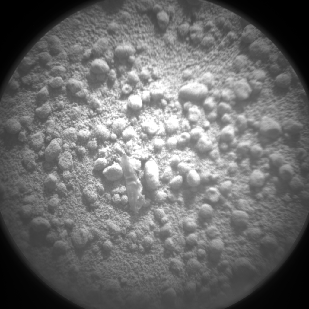
Various small bits of light-toned material on the ground at Rocknest have affected the rover's activities in the past several days. One piece about half an inch (1.3 centimeters) long was noticed on Oct. 7. The rover team postponed use of the robotic arm for two days while investigating this object, and assessed it to be debris from the spacecraft.
Images taken after Curiosity collected its second scoop of Rocknest material on Oct. 12 showed smaller bits of light-toned material in the hole dug by the scooping action. This led to discarding that scoopful rather than using it to scrub the processing mechanisms. Scientists assess these smaller, bright particles to be native Martian material, not from the spacecraft.
"We plan to learn more both about the spacecraft material and about the smaller, bright particles," said Curiosity Project Manager Richard Cook of NASA's Jet Propulsion Laboratory, Pasadena. "We will finish determining whether the spacecraft material warrants concern during future operations. The native Mars particles become fodder for the mission's scientific studies."
During a two-year prime mission, researchers are using Curiosity's 10 instruments to assess whether the study area has ever offered environmental conditions favorable for microbial life. JPL, a division of Caltech, manages the project and built Curiosity. For more about Curiosity, visit: http://www.nasa.gov/msl and http://mars.jpl.nasa.gov/msl .
You can follow the mission on Facebook and Twitter at: http://www.facebook.com/marscuriosity and http://www.twitter.com/marscuriosity .
Guy Webster 818-354-6278
Jet Propulsion Laboratory, Pasadena, Calif.
guy.webster@jpl.nasa.gov
A NASA's Mars Curiosity rover team member gives an update on developments and status of the planetary exploration mission. The Mars Science Laboratory spacecraft delivered Curiosity to its target area on Mars at 1:31:45 a.m. EDT on Aug. 6, which includes the 13.8 minutes needed for confirmation of the touchdown to be radioed to Earth at the speed of light. The rover will conduct a nearly two-year prime mission to investigate whether the Gale Crater region of Mars ever offered conditions favorable for microbial life.
Curiosity carries 10 science instruments with a total mass 15 times as large as the science payloads on NASA's Mars rovers Spirit and Opportunity. Some of the tools, such as a laser-firing instrument for checking rocks' elemental composition from a distance, are the first of their kind on Mars. Curiosity will use a drill and scoop, which are located at the end of its robotic arm, to gather soil and powdered samples of rock interiors, then sieve and parcel out these samples into the rover's analytical laboratory instruments.
miércoles, 10 de octubre de 2012
View of Curiosity's First Scoop Also Shows Bright Object
ORIGINAL: NASA
 |
| Image credit: NASA/JPL-Caltech/MSSS |
This image was taken during the mission's 61st Martian day, or sol (Oct. 7, 2012), the same sol as the first scooping. After examining Sol 61 imaging, the rover team decided to refrain from using the arm on Sol 62 (Oct. 8). Instead, the rover was instructed to acquire additional imaging of the bright object, on Sol 62, to aid the team in assessing possible impact, if any, to sampling activities.
For scale, the scoop is 1.8 inches (4.5 centimeters) wide, 2.8 inches (7 centimeters) long.
sábado, 15 de septiembre de 2012
NASA Mars Rover Opportunity Reveals Geological Mystery
ORIGINAL: NASA
September 14, 2012
 |
| Puzzling Little Martian Spheres That Don't Taste Like 'Blueberries'. Small spherical objects fill the field in this mosaic combining four images from the Microscopic Imager on NASA's Mars Exploration Rover Opportunity. The view covers an area about 2.4 inches (6 centimeters) across, at an outcrop called "Kirkwood" in the Cape York segment of the western rim of Endeavour Crater. The individual spherules are up to about one-eighth inch (3 millimeters) in diameter. The Microscopic Imager took the component images during the 3,064th Martian day, or sol, of Opportunity's work on Mars (Sept. 6, 2012). For a color view of the Kirkwood outcrop as Opportunity was approaching it two weeks earlier, see PIA16128 . Opportunity discovered spherules at its landing site more than eight-and-a-half years earlier. Those spherules were nicknamed "blueberries." They provided important evidence about long-ago wet environmental conditions on Mars because researchers using Opportunity's science instruments identified them as concretions rich in the mineral hematite deposited by water saturating the bedrock. A picture of the "blueberries" from the same Microscopic Imager is PIA05564 . The spherules at Kirkwood do not have the iron-rich composition of the blueberries. They also differ in concentration, distribution and structure. Some of the spherules in this image have been partially eroded away, revealing concentric internal structure. Opportunity's science team plans to use the rover for further investigation of these spherules to determine what evidence they can provide about ancient Martian environmental conditions. Image credit: NASA/JPL-Caltech/Cornell Univ./ USGS/Modesto Junior College |
 |
| Small spherical objects fill the field in this mosaic combining four images from the Microscopic Imager on NASA's Mars Exploration Rover Opportunity. Image credit: NASA/JPL-Caltech/Cornell Univ./ USGS/Modesto Junior College |
PASADENA, Calif. -- NASA's long-lived rover Opportunity has returned an image of the Martian surface that is puzzling researchers.
Spherical objects concentrated at an outcrop Opportunity reached last week differ in several ways from iron-rich spherules nicknamed "blueberries" the rover found at its landing site in early 2004 and at many other locations to date.
Opportunity is investigating an outcrop called Kirkwood in the Cape York segment of the western rim of Endeavour Crater. The spheres measure as much as one-eighth of an inch (3 millimeters) in diameter. The analysis is still preliminary, but it indicates that these spheres do not have the high iron content of Martian blueberries.
"This is one of the most extraordinary pictures from the whole mission," said Opportunity's principal investigator, Steve Squyres of Cornell University in Ithaca, N.Y. "Kirkwood is chock full of a dense accumulation of these small spherical objects. Of course, we immediately thought of the blueberries, but this is something different. We never have seen such a dense accumulation of spherules in a rock outcrop on Mars."
The Martian blueberries found elsewhere by Opportunity are concretions formed by action of mineral-laden water inside rocks, evidence of a wet environment on early Mars. Concretions result when minerals precipitate out of water to become hard masses inside sedimentary rocks. Many of the Kirkwood spheres are broken and eroded by the wind. Where wind has partially etched them away, a concentric structure is evident.
Opportunity used the microscopic imagern its arm to look closely at Kirkwood. Researchers checked the spheres' composition by using an instrument called the Alpha Particle X-Ray Spectrometer on Opportunity's arm.
"They seem to be crunchy on the outside, and softer in the middle," Squyres said. "They are different in concentration. They are different in structure. They are different in composition. They are different in distribution. So, we have a wonderful geological puzzle in front of us. We have multiple working hypotheses, and we have no favorite hypothesis at this time. It's going to take a while to work this out, so the thing to do now is keep an open mind and let the rocks do the talking."
Just past Kirkwood lies another science target area for Opportunity. The location is an extensive pale-toned outcrop in an area of Cape York where observations from orbit have detected signs of clay minerals. That may be the rover's next study site after Kirkwood. Four years ago, Opportunity departed Victoria Crater, which it had investigated for two years, to reach different types of geological evidence at the rim of the much larger Endeavour Crater.
The rover's energy levels are favorable for the investigations. Spring equinox comes this month to Mars' southern hemisphere, so the amount of sunshine for solar power will continue increasing for months.
"The rover is in very good health considering its 8-1/2 years of hard work on the surface of Mars," said Mars Exploration Rover Project Manager John Callas of NASA's Jet Propulsion Laboratory in Pasadena, Calif. "Energy production levels are comparable to what they were a full Martian year ago, and we are looking forward to productive spring and summer seasons of exploration."
NASA launched the Mars rovers Spirit and Opportunity in the summer of 2003, and both completed their three-month prime missions in April 2004. They continued bonus, extended missions for years. Spirit finished communicating with Earth in March 2010. The rovers have made important discoveries about wet environments on ancient Mars that may have been favorable for supporting microbial life.
JPL manages the Mars Exploration Rover Project for NASA's Science Mission Directorate in Washington.
To view the image of the area, visit:
http://www.nasa.gov/mission_pages/mer/multimedia/pia16139.html
http://www.nasa.gov/mission_pages/mer/multimedia/pia16139.html
For more information about Opportunity, visit:
http://www.nasa.gov/rovers and http://marsrovers.jpl.nasa.gov .
http://www.nasa.gov/rovers and http://marsrovers.jpl.nasa.gov .
You can follow the project on Twitter and on Facebook at:
http://twitter.com/MarsRovers andhttp://www.facebook.com/mars.rovers .
http://twitter.com/MarsRovers andhttp://www.facebook.com/mars.rovers .
martes, 28 de agosto de 2012
El fascinante hallazgo geológico de Curiosity en Marte
ORIGINAL: BBC
Redacción BBC Mundo
Martes, 28 de agosto de 2012
 |
| Curiosity detectó una "discordancia" en las capas del Monte Sharp. |
El explorador de Marte, Curiosity, está dedicado a un frenesí de actividad de multimedios, antes de su misión científica propiamente dicha.
Por lo pronto, envió la primera foto de su teleobjetivo de 100 milímetros, que ya detectó una intrigante "discordancia" geológica.
Contenido relacionado
La Nasa también dio a conocer una foto panorámica en colores del Monte Sharp, la meta definitiva del explorador.
Este lunes, el robot transmitió "la primera grabación de una voz en ser enviada a otro planeta", y el martes transmitirá una canción del artista will.i.am, como parte de un evento educativo.
Pero junto a estas manifestaciones, Curiosity -también conocido como el Laboratorio de Ciencia de Marte- ya está afinando sus instrumentos para una misión científica de un alcance sin precedentes en el planeta rojo.
La Nasa dijo que el explorador ya ha enviado más información de Marte que todos los anteriores vehículos combinados de la agencia.
Eventualmente rodará hasta la base del Monte Sharp, la montaña de 5.000 metros de altura en el centro del cráter Gale, en el que aterrizó hace poco más de tres semanas.
Herramientas de lujo
Por ahora está examinando las "marcas de la erosión" dejadas por la grúa propulsada por cohetes que descendió al explorador hasta la superficie del planeta, dando así una visión de lo que se encuentra justo debajo de él.
El explorador empleará ahora su albedo dinámico de neutrones o instrumento Dan, que dispara las partículas subatómicas en la superficie para examinar los niveles de hidrógeno y minerales con hidroxilo, que podrían dar indicios de una previa historia de Marte rica en agua.
 |
| Las fotos fueron tomadas el 23 de agosto con una cámara de 34 milímetros. |
Otra herramienta de su arsenal, el espectrómetro ChemCam, que usa un láser para vaporizar rocas y luego examinar químicamente el vapor, también mirará las marcas de la erosión.
Y el Análisis de muestras en Marte o instrumento Sam, un paquete de tres herramientas de análisis, ya está encendido y se está probando en anticipación a su "olfateo" de la atmósfera marciana. Las pruebas incluyen el análisis de una muestra de aire de la Tierra que quedó adentro en el lanzamiento.
Pero lo que ya ha capturado el interés de los ingenieros de la Nasa es la llamada "discordancia" detectada en las primeras imágenes del Monte Sharp enviadas por el explorador.
El término se refiere una pieza evidentemente ausente en el registro geológico, donde una capa de sedimento que no se alinea geológica y perfectamente con la de encima.
Las imágenes desde la órbita indicaron que las colinas más bajas del Monte Sharp consistían en sedimentos planos ricos en minerales "hidratados", formados en presencia de agua, pero las capas encima parecían carecer de los minerales.
Ahora bien, el Mastcam del explorador -que brinda la nueva imagen panorámica en color- ha tomado una imagen de la brecha, que muestra sedimentos aparentemente depositados en un ángulo marcadamente diferente de aquellos debajo de ellos. Depósitos similares sobre la Tierra pueden surgir debido a actividad tectónica o volcánica.
 |
| Los puntos blancos marcan la línea entre dos diferentes estratos geológicos. |
Desvío
Sin embargo, investigaciones posteriores tendrán que esperar un tiempo, mientras Curiosity hace un pequeño desvío.
La actividad de multimedios del explorador continuará mientras realiza un trayecto corto de 10 metros y se dedica el martes a tomar estereogramas: como nuestros ojos, combinando dos imágenes para lograr información acerca de profundidad y distancia.
A las 20:00 GMT, transmitirá una nueva canción de will.i.am, que pasará la televisión de la Nasa, como parte de una iniciativa para la educación primaria que hará uso de la tecnología de la agencia, incluido el explorador.
El lunes, el robot recibió y mandó de vuelta un mensaje grabado por el administrador de la Nasa, Charles Bolden, que decía: "El conocimiento que esperamos ganar de nuestra observación y análisis del cráter Gale nos enseñará mucho sobre la posibilidad de vida en Marte, así como las posibilidades del pasado y el futuro de nuestro propio planeta".
La próxima parada para el explorador será Glenelg, 400 metros al este, que parece ser la intersección de tres distintas regiones geológicas; cosechas potencialmente ricas para la serie de herramientas de Curiosity.
"Cuando finalmente lleguemos a Glenelg, deseamos estudiar el promontorio y dar una mirada a los contactos entre los tres terrenos", dijo a la BBC Joy Crisp, una científica que trabaja en la misión.
De ahí partirá hacia la base del Monte Sharp en un viaje que tomará varios meses.
martes, 14 de agosto de 2012
Interactive Mars panorama: As close as you'll get to being there
ORIGINAL: CNet


Get a feel for what a vacation to Mars would look like with a moveable 360-degree view stitched together from images sent back by the Curiosity rover.
 |
| Take a visual trip to Mars.(Credit: Screenshot by Amanda Kooser/CNET) |
My brother sometimes threatens to run away and join the eventual one-way human mission to Mars. He can get a better idea of what would await him by checking out an interactive, panoramic view of the planet as seen by the Curiosity rover.
Panographer Andrew Bodrov posted an explorable image of Mars to 360Cities. This is what it would it would look like if Google had been able to attach a Street View camera to the rover.
You can zoom and rotate the image to get a detailed, immersive view of the rocky surface, horizon, and the rover itself. It's the next best thing to being there, but without the crushing cold and lack of oxygen.
Related stories
The impressive panorama is stitched together from images sent back by Curiosity. You can even count the pieces of debris scattered on the rover's top.
I recommend closing your curtains, turning off all the lights, queuing up David Bowie's "Life on Mars?," and turning on the full-screen mode.
 |
| The Curiosity panorama will also connect you to a Spirit rover panorama, where this tracks image comes from.(Credit: Screenshot by Amanda Kooser/CNET) |

Freelance writer Amanda C. Kooser covers gadgets and tech news with a twist for CNET's Crave blog. When not wallowing in weird gadgets and iPad apps for cats, she can be found tinkering with her 1956 DeSoto.
martes, 7 de agosto de 2012
Curiosity's First Color Image of the Martian Landscape
ORIGINAL: NASA
This view of the landscape to the north of NASA's Mars rover Curiosity was acquired by the Mars Hand Lens Imager (MAHLI) on the afternoon of the first day after landing. (The team calls this day Sol 1, which is the first Martian day of operations; Sol 1 began on Aug. 6, 2012.)
In the distance, the image shows the north wall and rim of Gale Crater. The image is murky because the MAHLI's removable dust cover is apparently coated with dust blown onto the camera during the rover's terminal descent. Images taken without the dust cover in place are expected during checkout of the robotic arm in coming weeks.
The MAHLI is located on the turret at the end of Curiosity's robotic arm. At the time the MAHLI Sol 1 image was acquired, the robotic arm was in its stowed position. It has been stowed since the rover was packaged for its Nov. 26, 2011, launch.
The MAHLI has a transparent dust cover. This image was acquired with the dust cover closed. The cover will not be opened until more than a week after the landing.
When the robotic arm, turret, and MAHLI are stowed, the MAHLI is in a position that is rotated 30 degrees relative to the rover deck. The MAHLI image shown here has been rotated to correct for that tilt, so that the sky is "up" and the ground is "down".
When the robotic arm, turret, and MAHLI are stowed, the MAHLI is looking out from the front left side of the rover. This is much like the view from the driver's side of cars sold in the USA.
The main purpose of Curiosity's MAHLI camera is to acquire close-up, high-resolution views of rocks and soil at the rover's Gale Crater field site. The camera is capable of focusing on any target at distances of about 0.8 inch (2.1 centimeters) to infinity. This means it can, as shown here, also obtain pictures of the Martian landscape.
 |
| Image credit: NASA/JPL-Caltech/Malin Space Science Systems |
Suscribirse a:
Entradas (Atom)