Mostrando entradas con la etiqueta USGS. Mostrar todas las entradas

sábado, 30 de marzo de 2013

Extracted Oil And Gas Wastewater Causing Earthquakes?

March 29, 2013


A 2011 magnitude 5.7 quake in OK, linked to wastewater injection, buckled US Highway 62. (Credit: John Leeman)
After pulling massive amounts of fossil fuels out of the Earth’s crust so we can burn it up into our atmosphere, we have a good sense of where the stuff goes. Our oceans. A global greenhouse. Our lungs. But what happens to the ground formerly occupied by those fossil fuels?

It’s becoming increasingly clear that oil and gas extraction processes are actually weakening the structural integrity of the Earth’s crust just enough to cause more frequent earthquakes, in places not used to them.

Oklahoma, for instance, is not known for earthquakes. Yet the central U.S. has seen an elevenfold jump in recent years, including the Sooner State’s largest earthquake on record. This 5.7-magnitude quake occurred on November 6, 2011 near Prague, Oklahoma. And research published yesterday in Geology from the University of Oklahoma, Columbia University, and the U.S. Geological Survey has made a direct connection to the disposal of wastewater from conventional oil production:

A new study in the journal Geology is the latest to tie a string of unusual earthquakes, in this case, in central Oklahoma, to the injection of wastewater deep underground. Researchers now say that the magnitude 5.7 earthquake near Prague, Okla., on Nov. 6, 2011, may also be the largest ever linked to wastewater injection. Felt as far away as Milwaukee, more than 800 miles away, the quake — the biggest ever recorded in Oklahoma — destroyed 14 homes, buckled a federal highway and left two people injured. Small earthquakes continue to be recorded in the area.

The recent boom in U.S. energy production has produced massive amounts of wastewater. The water is used both in hydrofracking, which cracks open rocks to release natural gas, and in coaxing petroleum out of conventional oil wells. In both cases, the brine and chemical-laced water has to be disposed of, often by injecting it back underground elsewhere, where it has the potential to trigger earthquakes. The water linked to the Prague quakes was a byproduct of oil extraction at one set of oil wells, and was pumped into another set of depleted oil wells targeted for waste storage.

As Climate Progress has written before, this practice of disposing chemical-laced water generated during the extraction of oil and gas has far-reaching effects. Drillers have been doing this for more than a decade, and the researchers note that the Oklahoma quake did not actually require very much wastewater. In fact, because we have been doing this for so long, the built-up pressure in the Earth’s crust changes the criteria of how quakes happen. The study’s abstract notes:

Significantly, this case indicates that decades-long lags between the commencement of fluid injection and the onset of induced earthquakes are possible, and modifies our common criteria for fluid-induced events.

So we could be paying for more than a decade of wastewater injection and fracking for quite some time with earthquakes. There’s not much more room 9,000 feet down. Wellhead records indicate that pressure in these areas underground increased by a factor of ten from 2001 to 2006.

Fracking usually receives more attention for seismic activity than wastewater injection. Ohio banned fracking “to stop the ground from shaking.” But it’s the whole process of drilling (oil and gas), fracking, and then disposal that contributes to the problem.

A tanker truck prepares to leave OH Water plant that removes metals and chemicals from fracking wastewater. (Photo: Scott Galvin)
Can we stop doing this? Recycling the wastewater is cheaper, and more and more gas companies have started contracting out to do just that. But as Ohio Department of Natural Resources officials note, it’s hard to track where this water goes because it is not regulated. This is rather important because the water is laced with toxic metals, dangerous chemicals, and radium. Recycling companies say the waste ends up in landfills.

So the two options are to either inject it back down in the ground where it lubricates fault lines enough to cause earthquakes in Oklahoma and Ohio, or hope that radium doesn’t leak out of landfills.

Renewable fuels sound better and better the more we learn about enhanced drilling for unconventional oil and gas.

Authored by:
Joe Romm is a Fellow at American Progress and is the editor of Climate Progress, which New York Times columnist Tom Friedman called "the indispensable blog" and Time magazine named one of the 25 "Best Blogs of 2010." In 2009, Rolling Stone put Romm #88 on its list of 100 "people who are reinventing America." Time named him a "Hero of the Environment″ and “The Web’s most influential ...

martes, 19 de junio de 2012

Landsat Sets the Standard for Maps of World's Forests

ORIGINAL: Nasa

NASA's Earth-observing fleet of satellites provides a worldwide and unbiased view with standardized scientific data -- information crucial for tracking the health of the world's forests.

Countries like Brazil are using data from NASA satellites to track and measure their forests in advance of a United Nations effort to reduce climate change by providing "carbon credits" for protected land.

The concept is known as REDD+, which stands for Reducing Emissions from Deforestation and Forest Degradation. It includes monitoring forest degradation and efforts in conservation and sustainable management.

"REDD+ aims to make forests more valuable standing than they would be cut down, by creating a financial value for the carbon stored in trees," says Yemi Katerere, head of the United Nations' UN-REDD Programme Secretariat in Geneva, Switzerland. "It creates an incentive for developing countries to reduce carbon emissions by protecting, better managing and wisely using their forest resources, contributing to the global fight against climate change."

REDD+ will be a major topic of discussion during this week's Conference on Sustainable Development, known as Rio+20. Images and data acquired by Landsat satellites are increasingly becoming an accepted approach for anyone hoping to have a long-term view of the health of the world's forests.

"For example Brazil is using Landsat data from 1996 to 2005 to create a baseline for tracking future forest coverage," says Doug Morton, a NASA Landsat researcher at the NASA's Goddard Space Flight Center in Greenbelt, Md.


Tropical forest in Gabon, Africa. A NASA-led research team has used a variety of NASA satellite data to create the most precise map ever produced depicting the amount and location of carbon stored in Earth's tropical forests. Image credit: NASA/JPL-Caltech
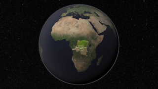
NASA's Earth-observing fleet of satellites provides a worldwide and unbiased view with standardized scientific data -- information crucial for tracking the health of the world's forests. Many non-profits are using Landsat as a tool to identify and protect areas that are important for conservation. This video shows how the African Wildlife Foundation (AWF) has used Landsat in the Democratic Republic of the Congo to protect a wildlife corridor in the Maringa Lopori Wanga (MLW) region. (Credit: NASA's Goddard Space Flight Center) 


Consistently gathering data about our planet since 1972, the Landsat Program is a series of Earth observing satellite missions jointly managed by NASA and the U.S. Geological Survey (USGS).

Landsat's views of Earth are at a 30 by 30 meter (32.8 yard) resolution, about the size of a baseball diamond. "That's a pretty appropriate scale for doing country-wide estimates of forest change," Morton says. 

"All 40 years of Landsat data is also readily available from the USGS archive at no cost to the end user," Morton says. "That makes it one of the only sources of freely available satellite data with that time record and at that spatial resolution."

Forest monitoring activities in developing countries heavily depend on guaranteed continuity and freely and open access to satellite data, says Inge Jonckheere of the UN-REDD Programme at the Food and Agriculture Organization of the U.N. in Rome, Italy.

"It allows them to learn and apply existing image processing techniques in order to become autonomous in monitoring their own forest nationally," Jonckheere says. "Landsat data therefore has been crucial in our work so far, which was mainly focused on the assessment of deforestation."


NASA's Earth-observing fleet of satellites provides a worldwide and unbiased view with standardized scientific data -- information crucial for tracking the health of the world's forests. Countries like Brazil are using data from NASA satellites to track and measure their forests in advance of a United Nations effort to reduce climate change by providing "carbon credits" for protected land. This file photo shows a forest in Gabon, Africa.(Credit: NASA/JPL-Caltech) 

NASA and the U.S. Department of the Interior through the U.S. Geological Survey (USGS) jointly manage Landsat. The USGS preserves the archive of Landsat images and distributes all of the 40-years of Landsat data free over the Internet.

"The ability of governments or other organizations to freely access all this data is one of the factors that's led to a major drop in deforestation in the last ten years," Morton says. 

In the 1990s deforestation caused nearly 20 percent of the world's greenhouse gas emissions, but in 2009 Morton and his research team reported that that number went down to 12 percent. Morton concedes that part of that change is due to an increase in all emissions due to expanded fossil fuels use.

"But the rise of satellite-based monitoring is also a factor." Morton says. "It provided a way for governments and conservation groups to monitor new laws protecting forests and track changes made by major agricultural industries like palm oil plantations and soybean farmers.

"Data from satellites like Landsat have really changed the dynamic of deforestation in the last five to 10 years," he says. 

The data will continue to flow. Landsat 7 remains in operation 13 years after its launch. The next satellite in the Landsat series, which began in 1972 with the launch of Landsat 1, is scheduled to launch in January 2013 from Vandenberg Air Force Base in Lompoc, Ca. Known as the Landsat Data Continuity Mission (LDCM), it is the eighth satellite in the series and will extend the world's longest-running satellite program for global land observations. 

In addition to deforestation and forest recovery, scientists and governments are very interested in quantifying the amount of carbon that is stored as trees and vegetation in forests. 

"Tropical forests are extremely diverse in species and structure and this diversity impacts their carbon content, an important quantity for estimating emissions from deforestation and degradation" says Sassan Saatchi, a scientist at NASA's Jet Propulsion Laboratory in Pasadena, Calif. Saatchi and his team created the world's first map of tropical forest carbon storage using quantitative satellite data in 2011 and found that the Amazon stores most of the carbon in the tropics. 

Saatchi and his team use data from a suite of NASA satellites to map the forest carbon, including tree height from Geoscience Laser Altimeter System lidar on NASA's ICESat satellite, imagery from the Moderate Resolution Imaging Spectroradiometer (MODIS) instrument on NASA's Terra spacecraft, and active microwave data from NASA's Quick Scatterometer satellite (QuikSCAT) and the Shuttle Radar Topography Mission. 

The role of the REDD+ mechanism in achieving broader sustainable development goals will be further discussed at the U.N. Rio+20 conference, which takes place from June 20 to 22 in Rio de Janeiro, Brazil.

For more information about the Landsat Program, visit:


Aries Keck